Login

Zabudli ste prihlasovacia meno

Cookies have to be accepted!
Your browser's cookie functionality is disabled. Please enable this functionality.

Not a member yet?

Register now
Login

Available for registred users only

Log in to use this feature.

Zabudli ste prihlasovacia meno

Cookies have to be accepted!
Your browser's cookie functionality is disabled. Please enable this functionality.

Not a member yet?

Register now
Filter
Kategórie
Advanced filters
  • Dĺžka (km)
  • výškomer
Uložiť filter Reset filter

TrackRank

QRCode

Technical data

Dĺžka66,6 km výškomer1710 m Way down1708 m Doba06:05 h:m dátum15.05.2016
ohodnotenia Author Kraj pôžitok z túry kondícia technika

štatistika

1230 náhľady ohodnotenia 97 Stiahnutia priemer
Rate
  • list trasy
  • príjazd
  • Stiahnutia
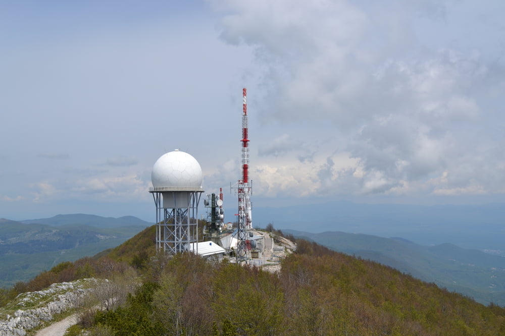
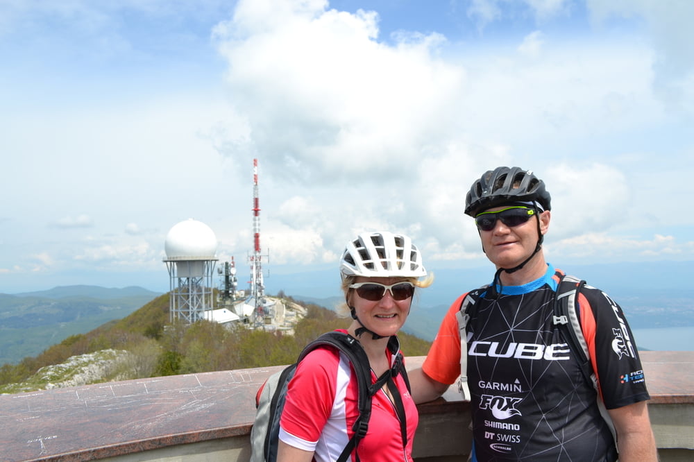
Ausgangspunkt war Lupoglav.Von da ging es auf den Vojak,da hat man einen tollen Ausblick ins Landesinnere und auf die Kvarnerbucht.60-70% ist Schotter.Den höchsten Punkt von Istrien,da muss man mit dem Bike gewesen sein.......

galéria trás

Mapa trasy a výškový profil

  • Open Street Map
  • Google
Minimum height 402 m Maximum height 1399 m Detailný pohľad

More about the tour author

plazo100
Member since 2009

Send private message

komentáre

GPS trasy

Trackpoints
  • GPX / Garmin Map Source (gpx) download
  • TCX / Garmin Training Center® (tcx) download
  • CRS / Garmin Training Center® (crs) download
  • Google Earth (kml) download
  • G7ToWin (g7t) download
  • TTQV (trk) download
  • Overlay (ovl) download
  • Fugawi (txt) download
  • Kompass (DAV) Track (tk) download
  • list trasy (pdf) download
  • Original file of the author (gpx) download

More about the tour author

plazo100
Member since 2009

Send private message
Share track
Add to my favorites
Remove from my favorites
Edit tags
My score
Rate
trasa: Höchster Berg von Istrien der Vojak 1401m
Druh: horský bicykel
Dĺžka: 66,6 km
Evaluated on:
Doba:
Day(s)
Hour(s)
Minute(s)
ohodnotenie: Kraj pôžitok z túry kondícia technika