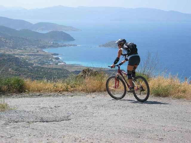
Von dem kleinen Fischerort Mohlos starten wir stets bergauf Richtung Sfaka. Anfangs auf Aspahlt, später nehmen wir den direkteren Weg duch ein wunderbares Tal. Kurz vor der Ortschaft Sfaka kommen wir wieder auf die Hauptstraße, die allerdings nicht allzu befahren ist. Von Sfaka führt uns der Weg weiter entland der Hauptstraße über Tourloti bis Mirsini. Immer wieder genießen wir die wunderbaren Ausblicke. Von Mirsini führt eine schmale Betonstraße und später Schotterweg wieder zurück zum Ausgangspunkt. Tip: Unbedingt in der Ortschaft Mohlos noch eine Fisch essen nach der Tour. Ist einfach grandios.
galéria trás
Mapa trasy a výškový profil
Minimum height -23 m
Maximum height 302 m
komentáre

Gestartet wird in Mohlos (ca. 35 km östlich von Ag. Nikolaos an der Küste). Die Tour führt gegen den Uhrzeigersinn. Übrigens vergeßt Wanderweg auf Kreta ohne Guide (meist unfahrbar). Auch Schotterwege, die in der Karte eingezeichnet sind, können ins Nichts führen. Oft sind Pfandfinderfähigkeiten gefragt. Auch solltet Ihr auf Kreta immer genug Schlauchpickzeug mitführen aufgrund der vielen Dornen!
GPS trasy
Trackpoints-
GPX / Garmin Map Source (gpx) download
-
TCX / Garmin Training Center® (tcx) download
-
CRS / Garmin Training Center® (crs) download
-
Google Earth (kml) download
-
G7ToWin (g7t) download
-
TTQV (trk) download
-
Overlay (ovl) download
-
Fugawi (txt) download
-
Kompass (DAV) Track (tk) download
-
list trasy (pdf) download
-
Original file of the author (g7t) download
Add to my favorites
Remove from my favorites
Edit tags
Open track
My score
Rate


