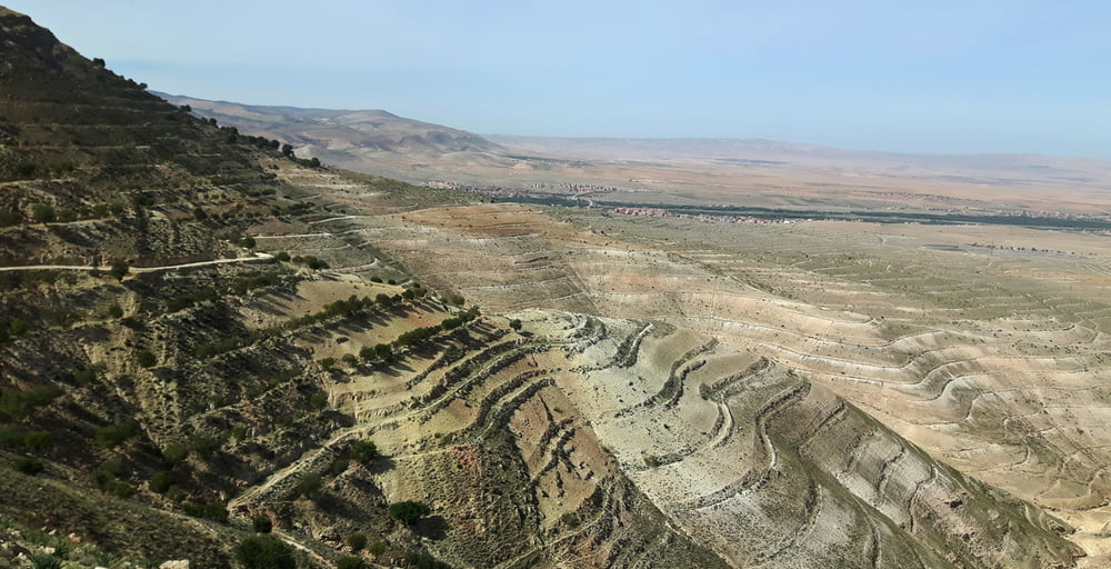
Aussichtsreich auf die ersten Berge des Hohen Atlas.
Rundtour im Uhrzeigersinn, S0 + (verlängerbar)
12% Asphalt, 47% Sandstrasse, 34% Karrenweg, 1% Singletrail
RAUF:
Meist leicht rumpelig geht’s auf einer schmalen Sandstrasse, die später zu einem Karrenweg wird, kontinuierlich steigend rauf zu einem Pass. Unterwegs gibt’s Aussicht in die bizarre Wüstenlandschaft der ersten Hügel des Hohen Atlas.
RUNTER:
Ebenfalls leicht rumpelig, auf einem Gemisch aus Sandstrassen und Karrenwegen (S0+), geht’s hübsch durch Terrassenfelder, durch zwei kleine Dörfer und durch ein Flussbett hinunter ins Tal. Als Abschluss durchquert man die geschäftige Kleinstadt Imintanoute.
EINKEHR: Unterwegs keine, Möglichkeit in Imintanoute
START+ENDE: Auf einem Parkplatz in Imintanoute an der R212
Anmerkungen
Wer verlängern mag: Ab dem Pass führt die Sandstrasse noch auf einen Bergrücken in 2000m Seehöhe rauf.
Singletrail – Schwierigkeitsbewertung: http://www.singletrail-skala.de
Für GPX Nutzer sind bei zweifelhaften Abzweigungen (die im spitzen Winkel) im Track Hackerl in die abzubiegende Richtung gezeichnet.
galéria trás
Mapa trasy a výškový profil
komentáre

GPS trasy
Trackpoints-
GPX / Garmin Map Source (gpx) download
-
TCX / Garmin Training Center® (tcx) download
-
CRS / Garmin Training Center® (crs) download
-
Google Earth (kml) download
-
G7ToWin (g7t) download
-
TTQV (trk) download
-
Overlay (ovl) download
-
Fugawi (txt) download
-
Kompass (DAV) Track (tk) download
-
list trasy (pdf) download
-
Original file of the author (gpx) download


