
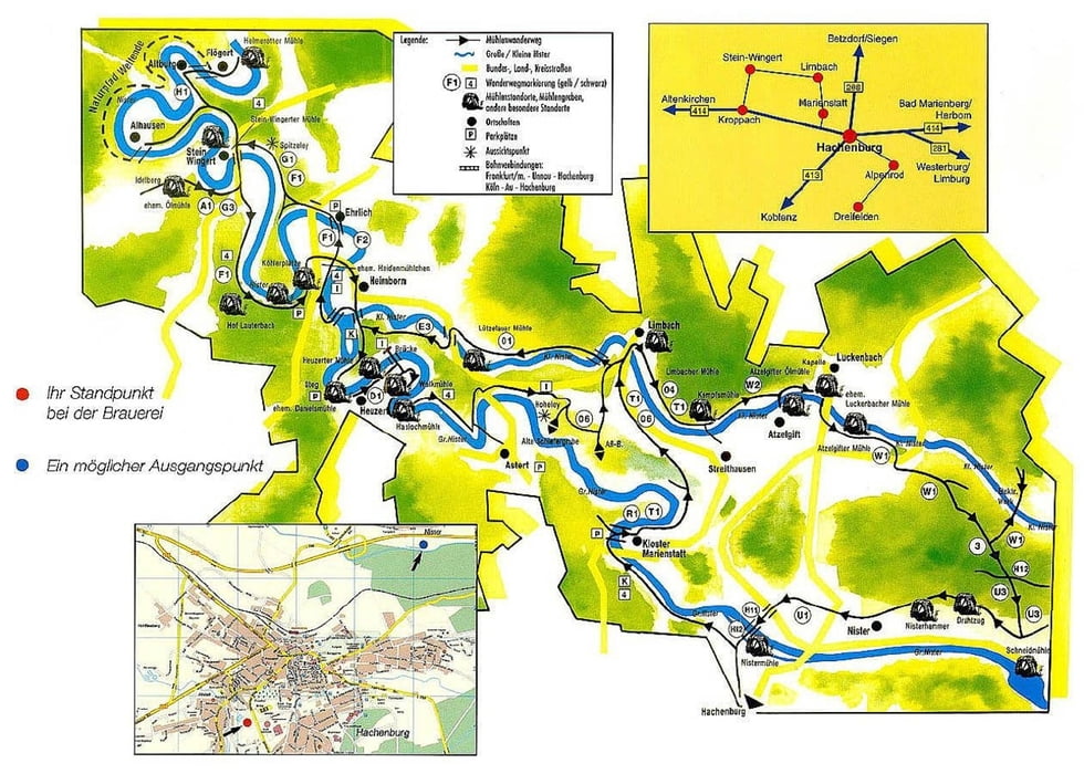

Diese Tour ist eine Rekonstruktion der Route Nr. 2 des "Historischen Mühlenwanderweges durch die Kroppacher Schweiz". Die alten Wegmarkierungen unterwegs (weißes Mühlenrad auf grünem Grund) sind vernachlässigt und kaum mehr wahrnehmbar - daher die hier erstellte GPS-Route als Navigationshilfe. An den jeweiligen "Stationen" sind teilweise Infotafeln angebracht.
Hier einige weiterführende Informationen:
- alter Flyer und Beschreibung des Wanderweges
- Wassermühlen in der Kroppacher Schweiz
- Mühlenplan der VG-Altenkirchen
- Informationen der VG-Altenkirchen
Die Basis meiner Rekonstruktion sind die o.g. Quellen sowie zusätzlich eine Wanderkarte mit Standort in der Nähe des Luckenbacher Friedhofs. Die Route Nr. 1 ist noch in Arbeit.
galéria trás


Mapa trasy a výškový profil
Minimum height 232 m
Maximum height 397 m
More about the tour author

|
Scherlock |
komentáre

Start des Weges ist das Dorfmuseum in Limbach. Parkmöglichkeiten sind am "Haus des Gastes" oder wahlweise am Wanderparkplatz in Limbach (am Friedhof).
GPS trasy
Trackpoints-
GPX / Garmin Map Source (gpx) download
-
TCX / Garmin Training Center® (tcx) download
-
CRS / Garmin Training Center® (crs) download
-
Google Earth (kml) download
-
G7ToWin (g7t) download
-
TTQV (trk) download
-
Overlay (ovl) download
-
Fugawi (txt) download
-
Kompass (DAV) Track (tk) download
-
list trasy (pdf) download
-
Original file of the author (gpx) download
More about the tour author
|
|
Scherlock |
Add to my favorites
Remove from my favorites
Edit tags
Open track
My score
Rate