


Endurotour im St. Galler Rheintal bei Buchs / Grabs / Vaduz (am Alvier)
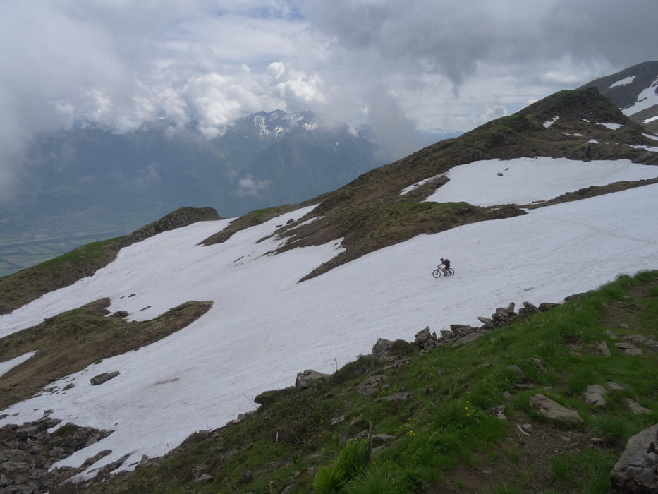
hinauf über ein paar anspruchsvolle schmale S1-S2 Trails, in Summe recht konditionsraubend. Strecke über den Voralpsee, Gasthof Malbun und ca. 200hm / 40min tragen zum Barbieler Grat. Am 10.06.17 hatte es noch markante Schneefelder (Länge 300m) deren Querung mit Rad am steilen Hang viel Sorgfalt erfoderte. 2Wochen später wird es einfacher werden. Vorsicht bei Schneefeldquerung, gute dichte rutschfeste Schuhe und ausreichend Kondition sind erforderlich. Es waren Schneehühner am Schneehang.
Am Barbieler Grat 1970m könnte man einen Abstecher zum 2350m hohen Alvier machen. Weiter ober wird es steiler, vermute da macht das Rad wenig Sinn.
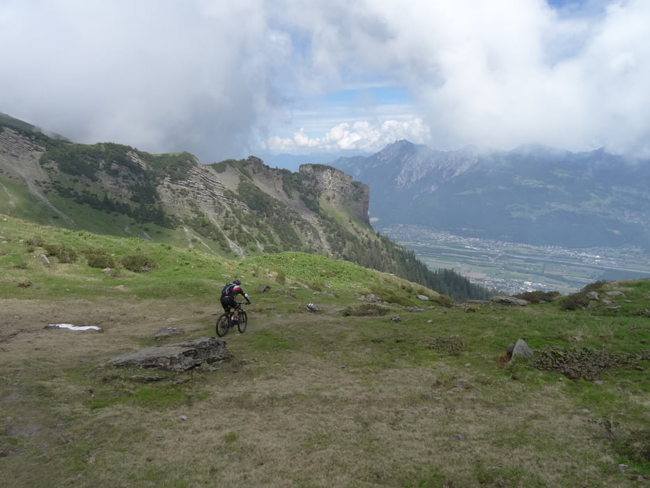
Hinunter meist S2 + auf schönen Wegen zurück nach Buchs. An ausgesetzten Stellen / Kurven Vorsicht. Die Tour hat einige Höhenmeter, den Voralpsee kann man weglassen -200hm, man kann auch die Strasse zum Gasthof Malbun nehmen. Am Schluß lohnt die Auffahrt von ca. 100hm auf dem gewählten Weg nicht, etwas anderes suchen. Der Tobel vor der Auffahrt am Schluß soll sehr viel Treppen haben.
galéria trás

Mapa trasy a výškový profil
Minimum height 442 m
Maximum height 1976 m
More about the tour author
|
|
skyhopper |
komentáre

parken praktisch überall gebührenpflichtig im Stadtbereich.
GPS trasy
Trackpoints-
GPX / Garmin Map Source (gpx) download
-
TCX / Garmin Training Center® (tcx) download
-
CRS / Garmin Training Center® (crs) download
-
Google Earth (kml) download
-
G7ToWin (g7t) download
-
TTQV (trk) download
-
Overlay (ovl) download
-
Fugawi (txt) download
-
Kompass (DAV) Track (tk) download
-
list trasy (pdf) download
-
Original file of the author (gpx) download
More about the tour author
|
|
skyhopper |
Add to my favorites
Remove from my favorites
Edit tags
Open track
My score
Rate