Login

Zabudli ste prihlasovacia meno

Cookies have to be accepted!
Your browser's cookie functionality is disabled. Please enable this functionality.

Not a member yet?

Register now
Login

Available for registred users only

Log in to use this feature.

Zabudli ste prihlasovacia meno

Cookies have to be accepted!
Your browser's cookie functionality is disabled. Please enable this functionality.

Not a member yet?

Register now
Filter
Kategórie
Advanced filters
  • Dĺžka (km)
  • výškomer
Uložiť filter Reset filter

TrackRank

QRCode

Technical data

Dĺžka110,4 km výškomer1457 m Way down1462 m Doba06:00 h:m dátum07.07.2017
ohodnotenia Author Kraj pôžitok z túry kondícia technika

štatistika

153 náhľady ohodnotenia 8 Stiahnutia priemer
Rate
  • list trasy
  • príjazd
  • Stiahnutia
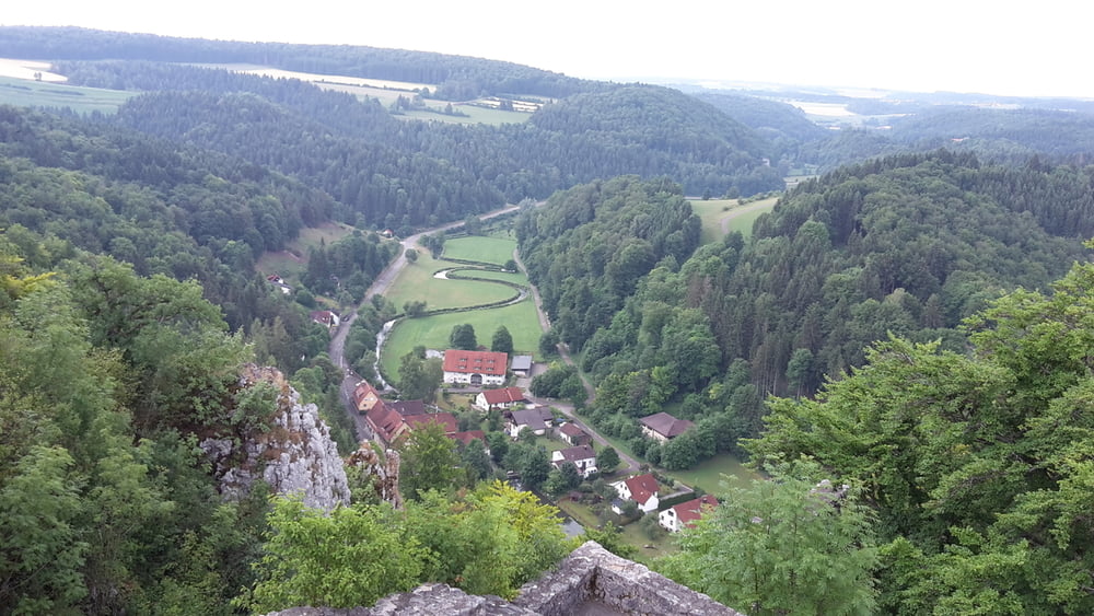
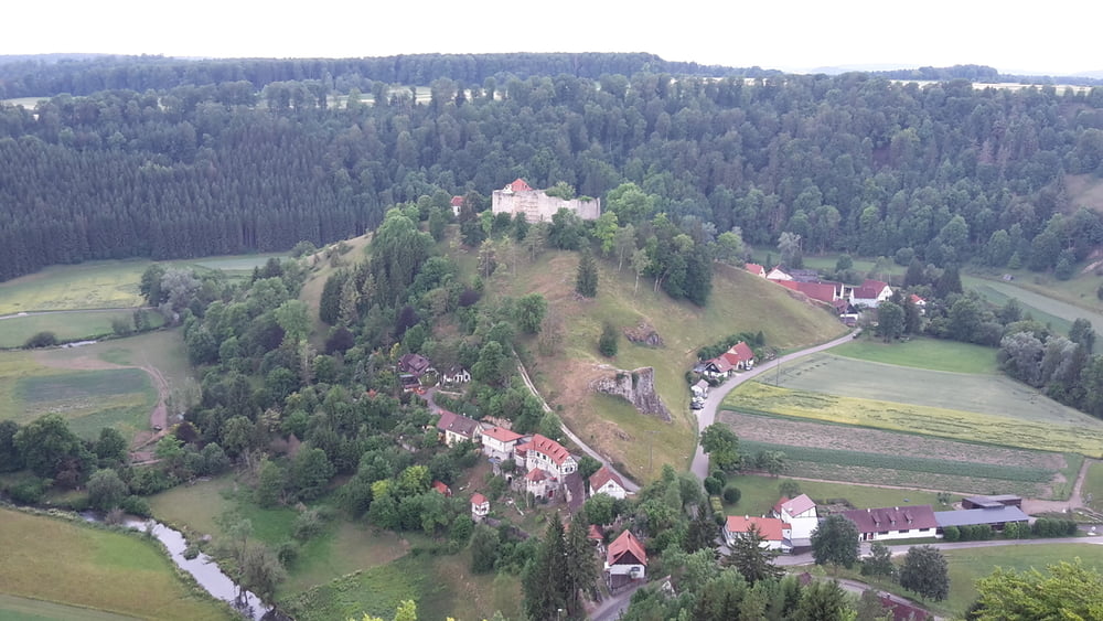
von Schemmerhofen auf die Schwäbische Alb zur Burg Hohengundelfingen und über Burg Derneck und Bussen zurück

galéria trás

Mapa trasy a výškový profil

  • Open Street Map
  • Google
Minimum height 510 m Maximum height 764 m Detailný pohľad

More about the tour author

eder_m
Member since 2008

Send private message

komentáre

GPS trasy

Trackpoints
  • GPX / Garmin Map Source (gpx) download
  • TCX / Garmin Training Center® (tcx) download
  • CRS / Garmin Training Center® (crs) download
  • Google Earth (kml) download
  • G7ToWin (g7t) download
  • TTQV (trk) download
  • Overlay (ovl) download
  • Fugawi (txt) download
  • Kompass (DAV) Track (tk) download
  • list trasy (pdf) download
  • Original file of the author (gpx) download

More about the tour author

eder_m
Member since 2008

Send private message
Share track
Add to my favorites
Remove from my favorites
Edit tags
My score
Rate
trasa: Hohengundelfingen
Druh: horský bicykel
Dĺžka: 110,4 km
Evaluated on:
Doba:
Day(s)
Hour(s)
Minute(s)
ohodnotenie: Kraj pôžitok z túry kondícia technika