Login

Zabudli ste prihlasovacia meno

Cookies have to be accepted!
Your browser's cookie functionality is disabled. Please enable this functionality.

Not a member yet?

Register now
Login

Available for registred users only

Log in to use this feature.

Zabudli ste prihlasovacia meno

Cookies have to be accepted!
Your browser's cookie functionality is disabled. Please enable this functionality.

Not a member yet?

Register now
Filter
Kategórie
Advanced filters
  • Dĺžka (km)
  • výškomer
Uložiť filter Reset filter

TrackRank

QRCode

Technical data

Dĺžka6,1 km výškomer380 m Way down485 m Doba04:00 h:m dátum12.07.2017
ohodnotenia Author Kraj pôžitok z túry kondícia technika

štatistika

531 náhľady ohodnotenia 21 Stiahnutia priemer
Rate
  • list trasy
  • príjazd
  • Stiahnutia

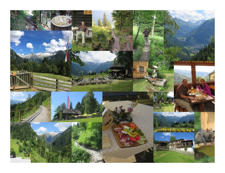
Der Aufstieg zur Poserhöhe beginnt beim Grünen Baum.

Dem Luis-Trenker-Steig folgend, am Bach entlang und kreuzend, geht es den Berg hinauf und nach ca. 1 Stunde erreicht man die Poserhöhe.

Die Hütte liegt perfekt auf einer Lichtung mit Sicht ins Tal.

Die Sommerliegen laden ein zum Verweilen und das kühle Weißbier schmeckt hervorragend.

Da es nur bis 14:00 Uhr warmes Essen gibt, entscheide ich mich für eine Brettl-Jause, die ich fast nicht zusammen essen kann. Ich genieße die Zeit auf der Poserhöhe und die Zeit vergeht im Flug :)

Für den Abstieg nehme ich den Wanderweg über die Alm und auf der Forststraße. Dann noch ein kleines Stück auf der Gamskarstraße und ich bin wieder am Ausgangspunkt meiner Wanderung.

Further information at

https://www.gasteinertal.com/poserhoehe/

Mapa trasy a výškový profil

  • Open Street Map
  • Google
Minimum height 1028 m Maximum height 1515 m Detailný pohľad

More about the tour author

huberj59
Member since 2009

Send private message

komentáre

An den Koordinaten N47° 07' 38.9" E13° 09' 28.5" findet man einen ausreichend großen Parkplatz, der gratis benutzt werden darf.

GPS trasy

Trackpoints
  • GPX / Garmin Map Source (gpx) download
  • TCX / Garmin Training Center® (tcx) download
  • CRS / Garmin Training Center® (crs) download
  • Google Earth (kml) download
  • G7ToWin (g7t) download
  • TTQV (trk) download
  • Overlay (ovl) download
  • Fugawi (txt) download
  • Kompass (DAV) Track (tk) download
  • list trasy (pdf) download
  • Original file of the author (gpx) download

More about the tour author

huberj59
Member since 2009

Send private message
Share track
Add to my favorites
Remove from my favorites
Edit tags
My score
Rate
trasa: Bad Gastein - Poserhöhe
Druh: trasa
Dĺžka: 6,1 km
Evaluated on:
Doba:
Day(s)
Hour(s)
Minute(s)
ohodnotenie: Kraj pôžitok z túry kondícia technika