Von Moab aus am Colorado entlang zum Trailhead. urzes Stück Schotterstraße, dann double Track, am Ende dann single Track. EIn Abstecher auf Sandstraße zum Rim mit Ausicht auf den Colorado.
Viel geholper, wie es typisch für Moab ist und auch Teile Slickrock.
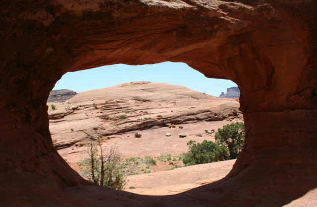
Ganz vorne gibt es noch ein Window zu besichtigen.
Der Jackson Trail hat viele technische und nicht ganz ungefährliche Stücke, vielleicht ab und zu laufen, statt fahren.
Unten, kurz vor dem Trailhead hatten wir Dank Hochwasser noch ein Kletterpartie zu meistern und mußten hüfthoch durchs Wasser waten (05/2008).
galéria trás
Mapa trasy a výškový profil
Minimum height 1207 m
Maximum height 1479 m
komentáre
Einfach zum Start der Tour fahren und dort den Wagen abstellen.
GPS trasy
Trackpoints-
GPX / Garmin Map Source (gpx) download
-
TCX / Garmin Training Center® (tcx) download
-
CRS / Garmin Training Center® (crs) download
-
Google Earth (kml) download
-
G7ToWin (g7t) download
-
TTQV (trk) download
-
Overlay (ovl) download
-
Fugawi (txt) download
-
Kompass (DAV) Track (tk) download
-
list trasy (pdf) download
-
Original file of the author (gpx) download
Add to my favorites
Remove from my favorites
Edit tags
Open track
My score
Rate


Moab