


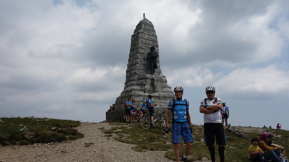
Der Grand Ballon ist mit 1.424m der höchste Gipfel der Vogesen. Die abwechslungsreiche Runde kostet einige Körner, die Auffahrt ist teilweise knackig. Dafür wird man mit schönen Ausblicken und auf der Abfahrt mit wunderschönen Trails belohnt.
Wir starten am Sportplatz in Vieux-Thann. Im Thurtal biken wir bis Mosch und nehmen auf einer Asphaltstraße den Anstieg nach Geishouse in Angriff. Ab Geishouse biken wir auf dem Wanderweg GR 532 bis zur Ferme-Auberge du Haag (1230m) an der Route des Crêtes. Bis zum Gipfel des Grand Ballon (1412m) mit seiner markanten Radarstation und dem Monument der als »Diables Bleus« (Blaue Teufel) bezeichneten Gebirgsjäger ist es nun nicht mehr weit. Die folgende Abfahrt führt uns anfangs über Almwiesen, später auf schön flüssig zu fahrenden Trails hinab zum Col Almic auf 828m. Einige ruppige Stellen überbrücken wir auf der Route des Cretes. Dabei orientieren wir uns an dem roten Rechteck des GR 5. Bis zur Ferme-Auberge Freundstein folgen wir nochmals kurz der Route de Cretes. Die zweite Hälfte der Abfahrt nach Thann ist dann eine Mischung aus flowigen Trails und Forstwegen, die erst an der Engelsbourg oberhalb von Thann ihr Ende findet.
galéria trás


Mapa trasy a výškový profil
Minimum height 326 m
Maximum height 1414 m
More about the tour author
|
|
ibenarsa |
komentáre

Parkplätze beim Sportgelände in Vieux Thann.
GPS trasy
Trackpoints-
GPX / Garmin Map Source (gpx) download
-
TCX / Garmin Training Center® (tcx) download
-
CRS / Garmin Training Center® (crs) download
-
Google Earth (kml) download
-
G7ToWin (g7t) download
-
TTQV (trk) download
-
Overlay (ovl) download
-
Fugawi (txt) download
-
Kompass (DAV) Track (tk) download
-
list trasy (pdf) download
-
Original file of the author (gpx) download
More about the tour author
|
|
ibenarsa |
Add to my favorites
Remove from my favorites
Edit tags
Open track
My score
Rate