Login

Zabudli ste prihlasovacia meno

Cookies have to be accepted!
Your browser's cookie functionality is disabled. Please enable this functionality.

Not a member yet?

Register now
Login

Available for registred users only

Log in to use this feature.

Zabudli ste prihlasovacia meno

Cookies have to be accepted!
Your browser's cookie functionality is disabled. Please enable this functionality.

Not a member yet?

Register now
Filter
Kategórie
Advanced filters
  • Dĺžka (km)
  • výškomer
Uložiť filter Reset filter

TrackRank

QRCode

Technical data

Dĺžka33,3 km výškomer165 m Way down152 m Doba02:00 h:m dátum27.04.2019
ohodnotenia Author Kraj pôžitok z túry kondícia technika

štatistika

285 náhľady ohodnotenia 30 Stiahnutia priemer
Rate
  • list trasy
  • príjazd
  • Stiahnutia

Sehr schöne und einfach Runde.

Startpunkt ist in Passau Ingling. Parkmöglichkeiten sind dort zahlreich vorhanden.

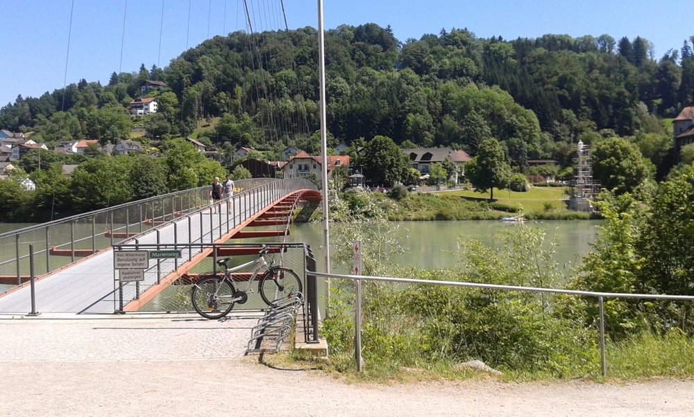
Es geht immer am Inn entlang mit nur kleinen Steigungen.

Die Strecke kann man mit Trekkingrad, Mountainbike fahren da es sich hier um Wald und festen Schotter handelt.

Auf der Strecke gibt es verschiedene Einkehrmöglichkeiten. Besonders Schärding ist ideal dafür.

Auf dem Rückweg kann man über das Stauwerk fahren oder wie hier dargestellt die etwas längere runde noch über Innstadt zurück zum Startpunkt

galéria trás

Mapa trasy a výškový profil

  • Open Street Map
  • Google
Minimum height 320 m Maximum height 353 m Detailný pohľad

More about the tour author

franz1962
Member since 2011

Send private message

komentáre

locki on 28.04.2019

Strecke halbieren

Auch in Wernstein, auf der Hälfte, kann man rasten und insbesondere den Inn überqueren. Bei meiner Kompasskarte (Planung) war der Übergang nicht eingezeichnet.

GPS trasy

Trackpoints
  • GPX / Garmin Map Source (gpx) download
  • TCX / Garmin Training Center® (tcx) download
  • CRS / Garmin Training Center® (crs) download
  • Google Earth (kml) download
  • G7ToWin (g7t) download
  • TTQV (trk) download
  • Overlay (ovl) download
  • Fugawi (txt) download
  • Kompass (DAV) Track (tk) download
  • list trasy (pdf) download
  • Original file of the author (gpx) download

More about the tour author

franz1962
Member since 2011

Send private message
Share track
Add to my favorites
Remove from my favorites
Edit tags
My score
Rate
trasa: Passau nach Schärding und zurück
Druh: horský bicykel
Dĺžka: 33,3 km
Evaluated on:
Doba:
Day(s)
Hour(s)
Minute(s)
ohodnotenie: Kraj pôžitok z túry kondícia technika