

Von Furthof aus folgen wir dem sehr gut beschilderten Wanderweg bzw. Forststraße entlang des Baches. Nach etwa 1,6 km erreichen wir den Parkplatz vor dem Aufstieg (Wanderweg 31).
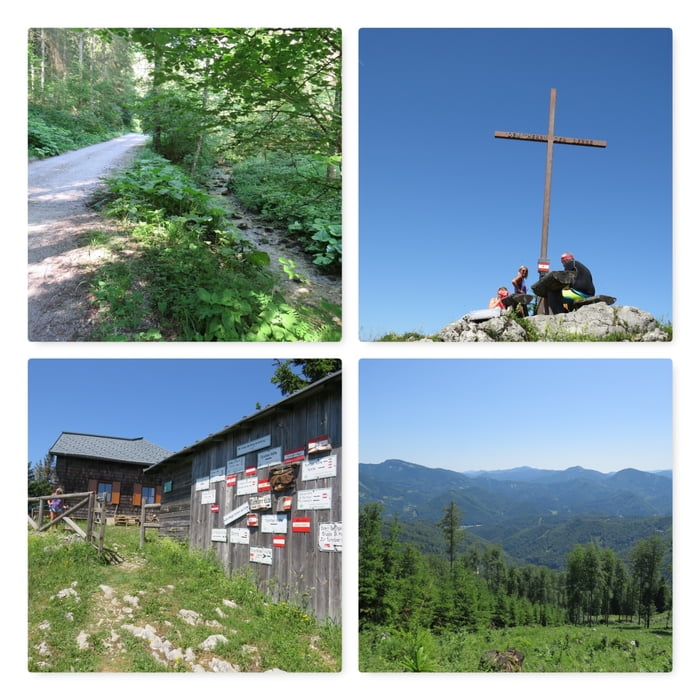
Der sehr gut beschilderte Wanderweg führt durch den Wald, steile Stellen und aktuell über sehr viele umgestürzte Bäume (die in den nächsten Tagen geschnitten werden sollen).
Der Aufstieg zur Hütte hat es in sich!
Doch die Mühe wird mit der Hütte, dem Gipfelkreuz und dem super Ausblick belohnt :)
Der Abstieg folgt der gleichen Route.
Further information at
http://www.alpenverein.at/tuernitzerhuette/Mapa trasy a výškový profil
Minimum height 461 m
Maximum height 1374 m
More about the tour author
|
|
huberj59 |
komentáre

Parkplatz: N47° 55' 33.3" E15° 36' 32.1" in Furthof oder N47° 55' 12.2" E15° 35' 23.2" im Wald, erreichbar über eine einspuriger Straße.
GPS trasy
Trackpoints-
GPX / Garmin Map Source (gpx) download
-
TCX / Garmin Training Center® (tcx) download
-
CRS / Garmin Training Center® (crs) download
-
Google Earth (kml) download
-
G7ToWin (g7t) download
-
TTQV (trk) download
-
Overlay (ovl) download
-
Fugawi (txt) download
-
Kompass (DAV) Track (tk) download
-
list trasy (pdf) download
-
Original file of the author (gpx) download
More about the tour author
|
|
huberj59 |
Add to my favorites
Remove from my favorites
Edit tags
Open track
My score
Rate