

Meine Wanderung startet am großen Parkplatz am Preiner Gscheid, Koordinaten N47 40 33.2 E15 43 23.8.
Ich folge der sehr guten Beschilderung Richtung Karl-Ludwig Haus in den Siebenbrunnenkessel bis zur Wegteilung rechts Waxriegelhaus und links über den Schlangenweg zum Karl-Ludwig Haus.
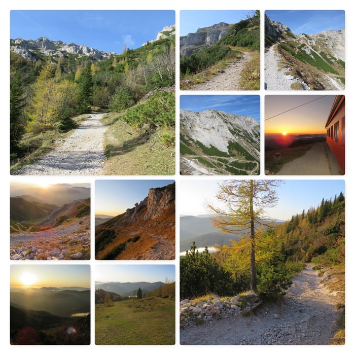
Bei diesem herrlichen Wetter macht es eine riesige Freude den sehr gut begehbaren Schlangenweg nach oben zu folgen. Nach rund 2 Stunden erreiche ich die Siebenbrunnenscharte.
Für den Abstieg über den Schlangenweg benötige ich rund 1 Stunde zurück zum Parkplatz am Preiner Gscheid.
Further information at
https://www.karlludwighaus.at/Mapa trasy a výškový profil
Minimum height 1035 m
Maximum height 1787 m
More about the tour author
|
|
huberj59 |
komentáre

Der große Parkplatz am Preiner Gscheid liegt an den Koordinaten N47 40 33.2 E15 43 23.8.
Das Preiner Gscheid erreicht man von Wien kommend über die A1 Südautobahn, dann S6 bis Ausfahrt Gloggnitz.
Die weitere Strecke führt entweder über Reichenau an der Rax oder Schottwien (landschaftlich weit schöner) bis zum Parkplatz.
GPS trasy
Trackpoints-
GPX / Garmin Map Source (gpx) download
-
TCX / Garmin Training Center® (tcx) download
-
CRS / Garmin Training Center® (crs) download
-
Google Earth (kml) download
-
G7ToWin (g7t) download
-
TTQV (trk) download
-
Overlay (ovl) download
-
Fugawi (txt) download
-
Kompass (DAV) Track (tk) download
-
list trasy (pdf) download
-
Original file of the author (gpx) download
More about the tour author
|
|
huberj59 |
Add to my favorites
Remove from my favorites
Edit tags
Open track
My score
Rate