Login

Zabudli ste prihlasovacia meno

Cookies have to be accepted!
Your browser's cookie functionality is disabled. Please enable this functionality.

Not a member yet?

Register now
Login

Available for registred users only

Log in to use this feature.

Zabudli ste prihlasovacia meno

Cookies have to be accepted!
Your browser's cookie functionality is disabled. Please enable this functionality.

Not a member yet?

Register now
Filter
Kategórie
Advanced filters
  • Dĺžka (km)
  • výškomer
Uložiť filter Reset filter

TrackRank

QRCode

Technical data

Dĺžka22,3 km výškomer1009 m Way down1011 m Doba00:00 h:m dátum06.06.2021
ohodnotenia Author Kraj pôžitok z túry kondícia technika

štatistika

212 náhľady ohodnotenia 17 Stiahnutia priemer
Rate
  • list trasy
  • príjazd
  • Stiahnutia

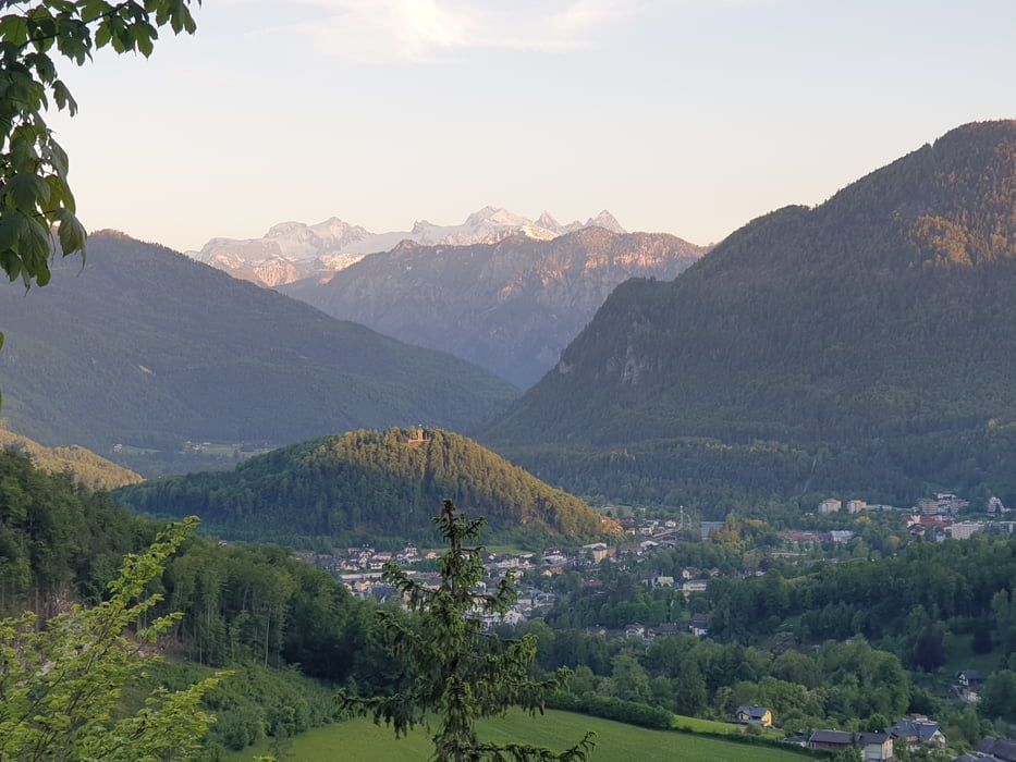
 Anspruchsvolle Tour. Ich fuhr mit einem E-Treckingrad. Schöne Aussicht auf den Dachstein und ins Tal. Stellenweise sehr steil (ich habe tw. geschoben). Forstgesetze beachten!


galéria trás

Mapa trasy a výškový profil

  • Open Street Map
  • Google
Minimum height 455 m Maximum height 1066 m Detailný pohľad

More about the tour author

gabo16
Member since 2016

Send private message

komentáre

Achtung Forstgesetze beachten.

GPS trasy

Trackpoints
  • GPX / Garmin Map Source (gpx) download
  • TCX / Garmin Training Center® (tcx) download
  • CRS / Garmin Training Center® (crs) download
  • Google Earth (kml) download
  • G7ToWin (g7t) download
  • TTQV (trk) download
  • Overlay (ovl) download
  • Fugawi (txt) download
  • Kompass (DAV) Track (tk) download
  • list trasy (pdf) download
  • Original file of the author (gpx) download

More about the tour author

gabo16
Member since 2016

Send private message
Share track
Add to my favorites
Remove from my favorites
Edit tags
My score
Rate
trasa: Bad Ischl - Saiherbachalm
Druh: horský bicykel
Dĺžka: 22,3 km
Evaluated on:
Doba:
Day(s)
Hour(s)
Minute(s)
ohodnotenie: Kraj pôžitok z túry kondícia technika