


- Rundkurs im Uhrzeigersinn.
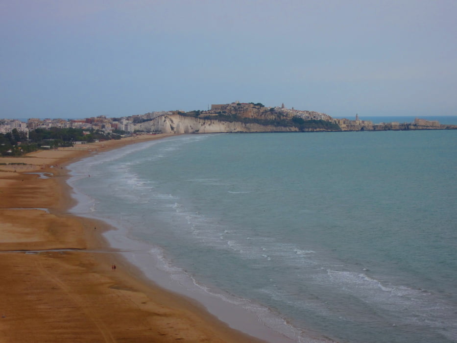
- Start/Ziel: Camping La Molinella/Vieste.
- Wegbeschaffenheit: 100% Asfalt.
- Vom Campingplatz bis Vieste auf wenig befahrener Provinzstrasse.
- Von Vieste bis KM 16,4 auf mässig befahrener Provinzstrasse.
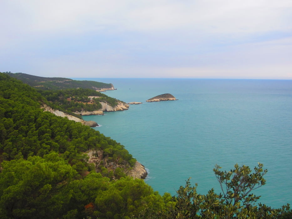
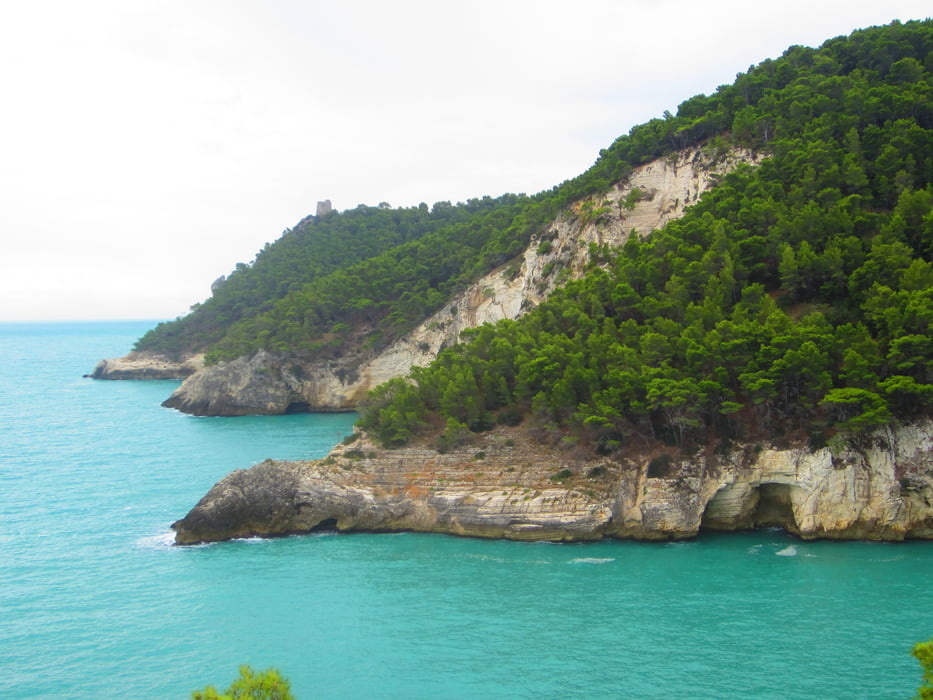
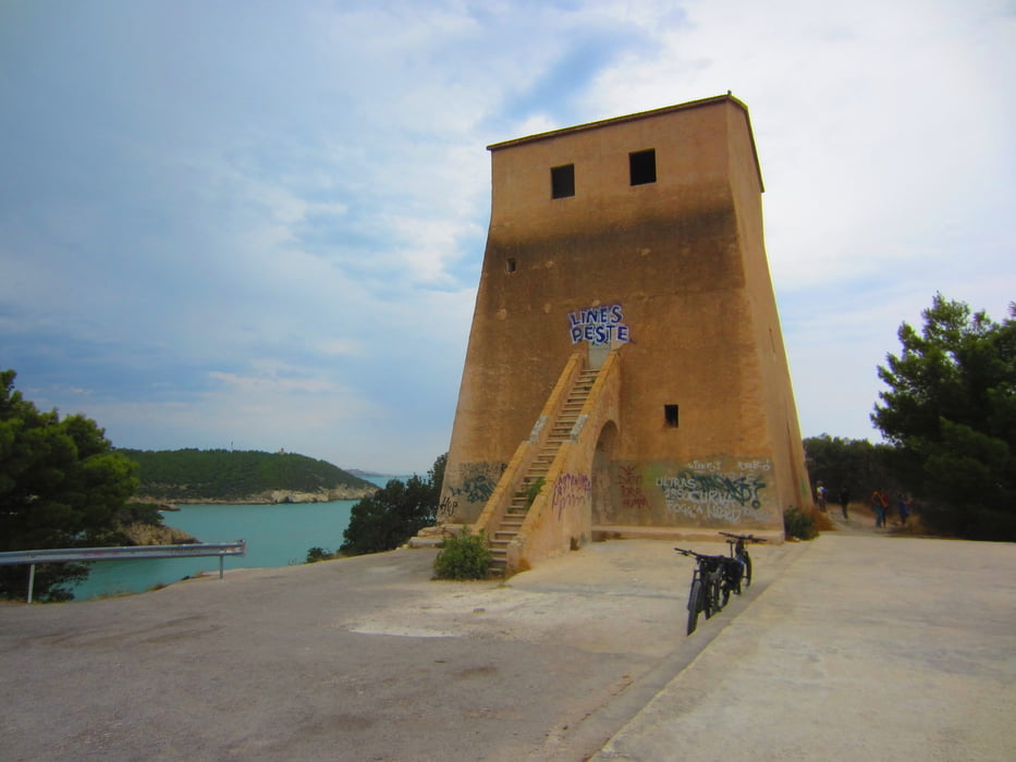
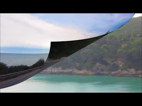
- Von KM 16,4 - 30,4 auf asfaltierter Panoramastrasse(kein Verkehr) auf und ab von einem Wachturm zum nächsten. Schöner Ausblick auf die Küste und deren einsame Buchten.
- Von KM 30,4 - 59 auf der mässig befahrenen Provinzstrasse bis Vieste.
- Bei KM 36, am entferntsten Punkt der Tour, befindet sich die Trattoria La Montagna.
- Wer den Strassenverkehr scheut, sollte an der Gabelung bei KM 30,4 auf der Panoramastrasse zurückfahren.
- PS. Die Steigungen sind angenehm.
- Ich bin die Tour am 4 Oktober gefahren. Das Verkehrsaufkommen ist während der Saison sicher grösser.
galéria trás
Mapa trasy a výškový profil
Minimum height -1 m
Maximum height 387 m
More about the tour author
|
|
MargesinFriedrich |
komentáre

GPS trasy
Trackpoints-
GPX / Garmin Map Source (gpx) download
-
TCX / Garmin Training Center® (tcx) download
-
CRS / Garmin Training Center® (crs) download
-
Google Earth (kml) download
-
G7ToWin (g7t) download
-
TTQV (trk) download
-
Overlay (ovl) download
-
Fugawi (txt) download
-
Kompass (DAV) Track (tk) download
-
list trasy (pdf) download
-
Original file of the author (gpx) download
More about the tour author
|
|
MargesinFriedrich |
Add to my favorites
Remove from my favorites
Edit tags
Open track
My score
Rate