

2. Tag
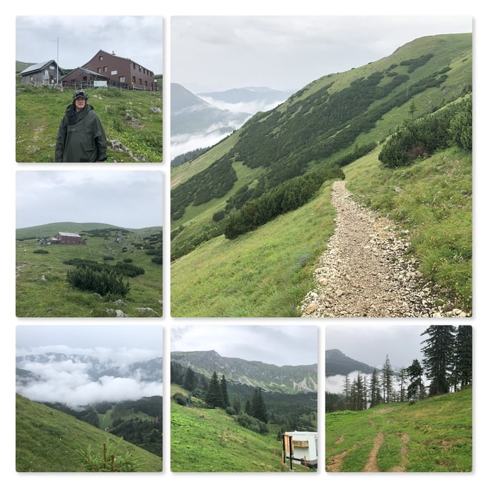
Leider beginnt auch der 2. Tag mit Wolken und Regen. Dennoch lassen wir uns das Frühstück gut schmecken und planen um. Der Teufelssteig wird ein anderes mal bewandert. Heute wollen wir den kürzesten Weg nach unten nehmen.
Vom Graf Meran Haus folgen wir der rot-weiß-roten Markierung zur Liftstütze und gehen anschließend den felsigen Steig hinunter.
Beim Lifthäuschen folgen wir der Lifttrasse bis zum Speicherteich und gehen dann (viele Kühe!) nicht über die Schipiste, sondern folgen der Forststraße bis zur Abzweigung (kurzes steiles Waldstück) zum Gasthof Scheikl.
Nach dem Gasthof Scheikl führt eine Schotterstraße hinunter zum Sessellift. Nun folgen wir dieser Schotterstraße bis zur Talstation "Die Gams", wo auch das Auto geparkt wurde.
Further information at
https://www.bergwelten.com/h/graf-meran-hausMapa trasy a výškový profil
Minimum height 1064 m
Maximum height 1837 m
More about the tour author
|
|
huberj59 |
komentáre

Der große Parkplatz bei der Talstation von "Die Gams" liegt an den Koordinaten N47° 37' 52.2" E15° 25' 48.9".
GPS trasy
Trackpoints-
GPX / Garmin Map Source (gpx) download
-
TCX / Garmin Training Center® (tcx) download
-
CRS / Garmin Training Center® (crs) download
-
Google Earth (kml) download
-
G7ToWin (g7t) download
-
TTQV (trk) download
-
Overlay (ovl) download
-
Fugawi (txt) download
-
Kompass (DAV) Track (tk) download
-
list trasy (pdf) download
-
Original file of the author (gpx) download
More about the tour author
|
|
huberj59 |
Add to my favorites
Remove from my favorites
Edit tags
Open track
My score
Rate