Login

Zabudli ste prihlasovacia meno

Cookies have to be accepted!
Your browser's cookie functionality is disabled. Please enable this functionality.

Not a member yet?

Register now
Login

Available for registred users only

Log in to use this feature.

Zabudli ste prihlasovacia meno

Cookies have to be accepted!
Your browser's cookie functionality is disabled. Please enable this functionality.

Not a member yet?

Register now
Filter
Kategórie
Advanced filters
  • Dĺžka (km)
  • výškomer
Uložiť filter Reset filter

TrackRank

QRCode

Technical data

Dĺžka55,6 km výškomer904 m Way down883 m Doba04:17 h:m dátum21.09.2024
ohodnotenia Author Kraj pôžitok z túry kondícia technika

štatistika

0 náhľady ohodnotenia 0 Stiahnutia priemer
Rate
  • list trasy
  • príjazd
  • Stiahnutia
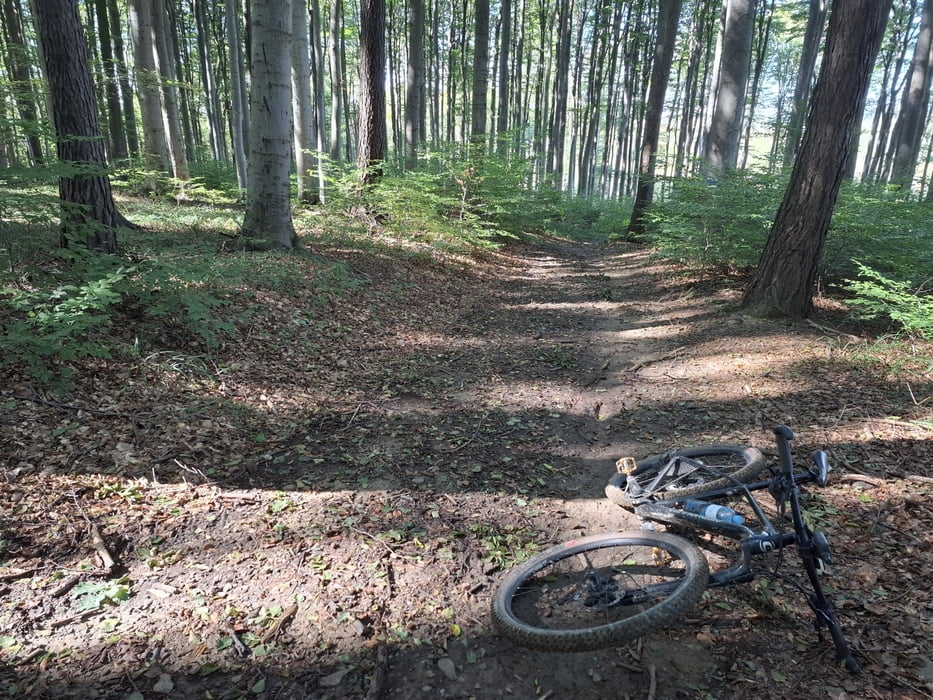
Nach dem großen Hochwasser war es überraschend gut fahrbar auch im Wald. Hin und wieder querliegende Bäume und ausgewaschene Wegerl. Einige gute trails!

galéria trás

Mapa trasy a výškový profil

  • Open Street Map
  • Google
Minimum height 186 m Maximum height 517 m Detailný pohľad

More about the tour author

mitter
Member since 2008

Send private message

komentáre

Start in Meidling, Nähe Bhf.

GPS trasy

Trackpoints
  • GPX / Garmin Map Source (gpx) download
  • TCX / Garmin Training Center® (tcx) download
  • CRS / Garmin Training Center® (crs) download
  • Google Earth (kml) download
  • G7ToWin (g7t) download
  • TTQV (trk) download
  • Overlay (ovl) download
  • Fugawi (txt) download
  • Kompass (DAV) Track (tk) download
  • list trasy (pdf) download
  • Original file of the author (gpx) download

More about the tour author

mitter
Member since 2008

Send private message
Share track
Add to my favorites
Remove from my favorites
Edit tags
My score
Rate
trasa: Hühnersteigberg-Tulbinger Kogel-Sophienalpe 240921
Druh: horský bicykel
Dĺžka: 55,6 km
Evaluated on:
Doba:
Day(s)
Hour(s)
Minute(s)
ohodnotenie: Kraj pôžitok z túry kondícia technika