

Spielmannsau bis zur Kemptner Hütte
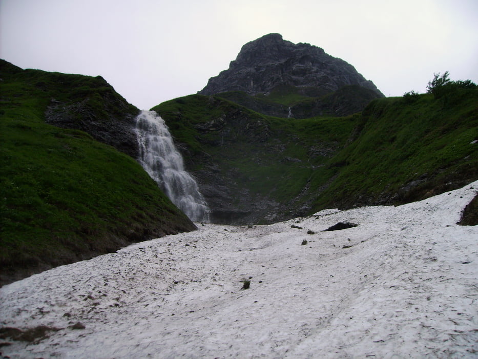
Die Strecke von der Spielmannsau bis zur Kemptner Hütte ist ausgesprochen sehenswert und macht vor allem auf den schmalen Wegen sehr viel Spaß.
Da wir an unserem zweiten Tag immer noch Regen hatten, sahen wir unzählige kleine Wasserläufe und die Landschaft war einfach nur herrlich. An vielen Stellen muss man breitere Bäche durchqueren, die bei starkem Regen etwas anspruchsvoller sind. Natürlich verändert sich die Technik-Note je nach Wettereinflüssen, aber auch bei starkem Regen leidet der Spaßfaktor keineswegs.
Die hm sind von mir grob geschätzt, aber man kann sich bei Google Earth selbst ein ganz gutes Bild von dem Gelände machen...
galéria trás


Mapa trasy a výškový profil
Minimum height 989 m
Maximum height 1809 m
More about the tour author
|
|
fetter_Homer |
komentáre

Über Teil 1
GPS trasy
Trackpoints-
GPX / Garmin Map Source (gpx) download
-
TCX / Garmin Training Center® (tcx) download
-
CRS / Garmin Training Center® (crs) download
-
Google Earth (kml) download
-
G7ToWin (g7t) download
-
TTQV (trk) download
-
Overlay (ovl) download
-
Fugawi (txt) download
-
Kompass (DAV) Track (tk) download
-
list trasy (pdf) download
-
Original file of the author (gpx) download
More about the tour author
|
|
fetter_Homer |
Add to my favorites
Remove from my favorites
Edit tags
Open track
My score
Rate