Login

Zabudli ste prihlasovacia meno

Cookies have to be accepted!
Your browser's cookie functionality is disabled. Please enable this functionality.

Not a member yet?

Register now
Login

Available for registred users only

Log in to use this feature.

Zabudli ste prihlasovacia meno

Cookies have to be accepted!
Your browser's cookie functionality is disabled. Please enable this functionality.

Not a member yet?

Register now
Filter
Kategórie
Advanced filters
  • Dĺžka (km)
  • výškomer
Uložiť filter Reset filter

TrackRank

QRCode

Technical data

Dĺžka34,1 km výškomer731 m Way down639 m Doba02:15 h:m dátum19.07.2008
ohodnotenia Author Kraj pôžitok z túry kondícia technika

štatistika

688 náhľady 1 ohodnotenie 110 Stiahnutia 4.00 priemer
Rate
  • list trasy
  • príjazd
  • Stiahnutia

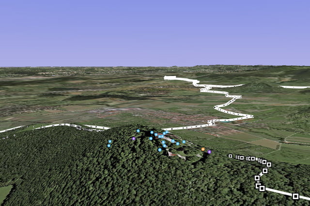
Super Tour über Bissingen Burg Teck, Gelber Fels, Rauber und Hepsisau.


Mapa trasy a výškový profil

  • Open Street Map
  • Google
Minimum height 318 m Maximum height 776 m Detailný pohľad

More about the tour author

hollyholly0002
Member since 2008

Send private message

komentáre

gami on 23.08.2008

schöne Feierabendrunde

schöne Tour mit netten Trails auf der Teck. Wir haben den Tour noch etwas erweitert und sind an der Ziegelhütte nicht auf der Strasse nach Hepsisau runter, sondern sind erst noch oben geblieben und zum Bahnhöfle (Ri Osten) weiter, dann am Neidlinger Wasserfall (Trail) vorbei runter. Strecke dann 38km
Über Autobahn A8 Ausfahrt Aichelberg Richtung Zell unter Aichelberg. Die Tour beginnt in der Nähe der Brücke am Autohaus Ratzel

GPS trasy

Trackpoints
  • GPX / Garmin Map Source (gpx) download
  • TCX / Garmin Training Center® (tcx) download
  • CRS / Garmin Training Center® (crs) download
  • Google Earth (kml) download
  • G7ToWin (g7t) download
  • TTQV (trk) download
  • Overlay (ovl) download
  • Fugawi (txt) download
  • Kompass (DAV) Track (tk) download
  • list trasy (pdf) download
  • Original file of the author (gpx) download

More about the tour author

hollyholly0002
Member since 2008

Send private message
Share track
Add to my favorites
Remove from my favorites
Edit tags
My score
Rate
trasa: Zell uA - Bissingen - Teck - Rauber - Hepsisau
Druh: horský bicykel
Dĺžka: 34,1 km
Evaluated on:
Doba:
Day(s)
Hour(s)
Minute(s)
ohodnotenie: Kraj pôžitok z túry kondícia technika