Login

Zabudli ste prihlasovacia meno

Cookies have to be accepted!
Your browser's cookie functionality is disabled. Please enable this functionality.

Not a member yet?

Register now
Login

Available for registred users only

Log in to use this feature.

Zabudli ste prihlasovacia meno

Cookies have to be accepted!
Your browser's cookie functionality is disabled. Please enable this functionality.

Not a member yet?

Register now
Filter
Kategórie
Advanced filters
  • Dĺžka (km)
  • výškomer
Uložiť filter Reset filter

TrackRank

QRCode

Technical data

Dĺžka6,9 km výškomer564 m Way down54 m Doba01:30 h:m dátum28.07.2008
ohodnotenia Author Kraj pôžitok z túry kondícia technika

štatistika

6160 náhľady 1 ohodnotenie 229 Stiahnutia 4.00 priemer
Rate
  • list trasy
  • príjazd
  • Stiahnutia

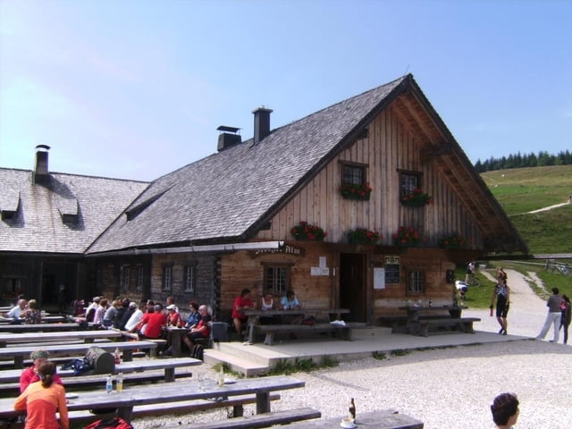
Eine der vielen Auffahrten auf die Stoißer Alm (Teisenberg). Parken kurz vor Adlgass bei Inzell; dem Track folgend zum Teil knackig (VDO-Tacho zeigte kurzzeitig bis 17 % Steigung an) an mehreren Abzweigungen vorbei bis in den Sattel. Nach dem folgenden Steilstück besteht die Möglichkeit, nach rechts auf ebenen Fußweg abzuzweigen. Schöner aber geradeaus und den Gipfel mitnehmen, man kann dann von der Bergseite zur Alm abfahren.

siehe auch die 7 anderen, von mir erfaßten Varianten:


/de/touren/detail.19567.html

/de/touren/detail.19652.html

/de/touren/detail.19665.html

/de/touren/detail.19888.html

/de/touren/detail.19890.html

/de/touren/detail.21282.html

/de/touren/detail.84482.html


Further information at

http://www.dav-teisendorf.de/dud/teisenberg.htm

galéria trás

Mapa trasy a výškový profil

  • Open Street Map
  • Google
Minimum height 774 m Maximum height 1325 m Detailný pohľad

komentáre

BAB München-Salzburg, Ausfahrt Siegsdorf, weiter Richtung Berchtesgaden, in Inzell links weg nach Adlgass

GPS trasy

Trackpoints
  • GPX / Garmin Map Source (gpx) download
  • TCX / Garmin Training Center® (tcx) download
  • CRS / Garmin Training Center® (crs) download
  • Google Earth (kml) download
  • G7ToWin (g7t) download
  • TTQV (trk) download
  • Overlay (ovl) download
  • Fugawi (txt) download
  • Kompass (DAV) Track (tk) download
  • list trasy (pdf) download
  • Original file of the author (gpx) download
Share track
Add to my favorites
Remove from my favorites
Edit tags
My score
Rate
trasa: Stoißer Alm 1 von Adlgass über die Bäckeralm
Druh: horský bicykel
Dĺžka: 6,9 km
Evaluated on:
Doba:
Day(s)
Hour(s)
Minute(s)
ohodnotenie: Kraj pôžitok z túry kondícia technika