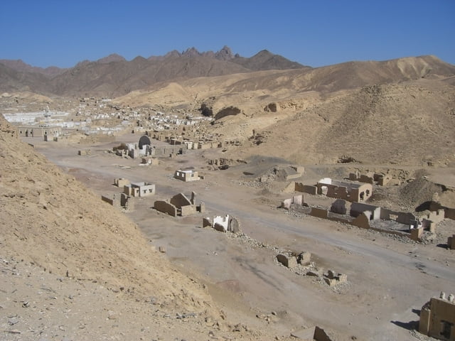
Anfangs ca 10km immer Gegenwind an der Küste entlang dann gehts in die Wüste auf einer gut zu fahrenden Stein-Sandpiste.
Höhepunkt ist die tote verlassene Stadt mit mehr als 400 Häusern.
Zurück geht es auf einer alten Eisenbahntrasse sogar durch nen Tunnel vorbei an einem Beduinen und nen kurze Cola Pause in einem Dorf ins Hotel
galéria trás
Mapa trasy a výškový profil
Minimum height -1 m
Maximum height 171 m
komentáre

Startpunkt ist das Hotel Magic Life Kalawy
GPS trasy
Trackpoints-
GPX / Garmin Map Source (gpx) download
-
TCX / Garmin Training Center® (tcx) download
-
CRS / Garmin Training Center® (crs) download
-
Google Earth (kml) download
-
G7ToWin (g7t) download
-
TTQV (trk) download
-
Overlay (ovl) download
-
Fugawi (txt) download
-
Kompass (DAV) Track (tk) download
-
list trasy (pdf) download
-
Original file of the author (gpx) download
Add to my favorites
Remove from my favorites
Edit tags
Open track
My score
Rate


