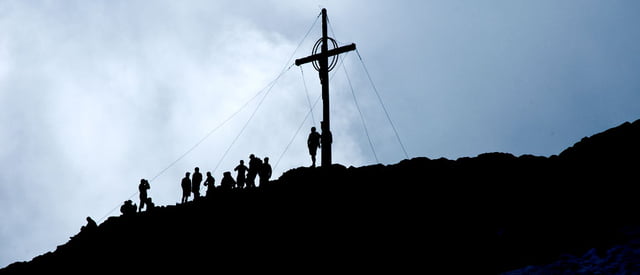
Die aussichtsreiche Bergtour führt von der Kuppelwieser Alm im Ultental zum Latscher Joch auf 2.500 m und dann weiter über den Nord-Ostkamm zum Gipfel des Hasenöhrl. Das Hasenöhrl, der östlichste Gletscher des Ortlergebietes, ist im Sommer leicht besteigbar und bietet grandiose Ausblicke auf die Gipfelwelt der Dolomiten.
Die Tour ist für trittsichere, etwas erfahrene Bergwanderer problemlos machbar, es wird keine Kletterausrüstung benötigt. Auch den Eispickel kann man getrost zu Hause lassen (zumindest im Sommer).
Eine ausführliche Tourbeschreibung mit Fotos (auch 360°) ist unter: Bergtour Hasenohr zu finden.
Further information at
http://www.diewanderer.it/hasenohr-hasenoehrl-dreitausender-gletscher-ortlergebiet/galéria trás
Mapa trasy a výškový profil
komentáre

Von der Brennerautobahn kommend über die Schnellstraße bis Lana und von dort ins Ultental. Weiter bis zum Zoggler-Stausee, dann rechts abbiegen zur Schwemmalm und schließlich bis zur Kuppelwieser Alm auf circa 1.900 m. Dort finden sich ausreichend Möglichkeiten, den PKW abzustellen.
GPS trasy
Trackpoints-
GPX / Garmin Map Source (gpx) download
-
TCX / Garmin Training Center® (tcx) download
-
CRS / Garmin Training Center® (crs) download
-
Google Earth (kml) download
-
G7ToWin (g7t) download
-
TTQV (trk) download
-
Overlay (ovl) download
-
Fugawi (txt) download
-
Kompass (DAV) Track (tk) download
-
list trasy (pdf) download
-
Original file of the author (gpx) download


