Login

Zabudli ste prihlasovacia meno

Cookies have to be accepted!
Your browser's cookie functionality is disabled. Please enable this functionality.

Not a member yet?

Register now
Login

Available for registred users only

Log in to use this feature.

Zabudli ste prihlasovacia meno

Cookies have to be accepted!
Your browser's cookie functionality is disabled. Please enable this functionality.

Not a member yet?

Register now
Filter
Kategórie
Advanced filters
  • Dĺžka (km)
  • výškomer
Uložiť filter Reset filter

TrackRank

QRCode

Technical data

Dĺžka42,9 km výškomer2550 m Way down2520 m Doba10:50 h:m dátum29.08.2008
ohodnotenia Author Kraj pôžitok z túry kondícia technika

štatistika

3015 náhľady ohodnotenia 106 Stiahnutia priemer
Rate
  • list trasy
  • príjazd
  • Stiahnutia

Hike and Bike Tour im großen Walsertal.

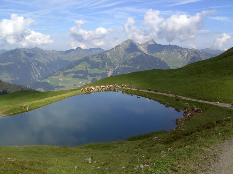
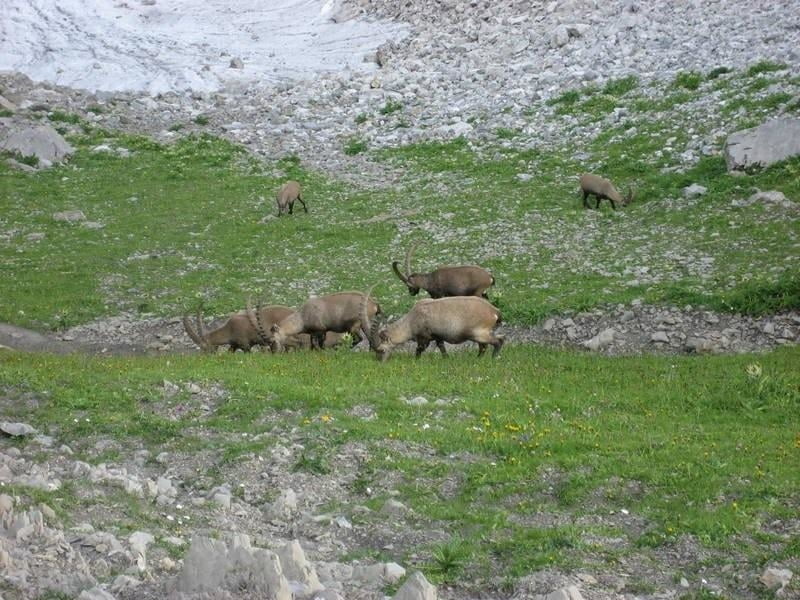
Start war in Sonntag-Garsella. Zunächst etwa 4 Km auf Verkehrsstraße nach Marul. Dann beginnt die Forststraße in angenehmer Steigung zur unteren und weiter zur oberen Laguzalpe. Hier bleiben die Bikes stehen. Nun geht es zu Fuß weiter in zunehmender Steigung  zu einer Scharte. Danach erreicht man mit wenigen Metern Höhenverlust den Nordgrat, der in etwa 2500 mtr. Höhe in leichter Kletterei (1-2) zum Gipfel führt. Der Abstieg ist zunächst der gleiche bis zur Abzweigung zur Scharte zwischen Rote Wand und Rothorn. Direkt unterhalb der Scharte zählten wir in unmittelbarer Entfernung etwa 20 Steinböcke. Nachdem wie die Tiere in Ruhe beobachten konnten, ging es direkt hinunter zur Freiburger Hütte. Am nächsten Morgen wanderten wir auf direktem Weg  zu den Rädern und fuhren über die Breithornhütte zurück zum Ausgangspunkt.

galéria trás

Mapa trasy a výškový profil

  • Open Street Map
  • Google
Minimum height 725 m Maximum height 2707 m Detailný pohľad

More about the tour author

yr1willi
Member since 2006

Send private message

komentáre

von Bludenz im Montafon Richtung Faschinajoch bis Sonntag-Garsella.

GPS trasy

Trackpoints
  • GPX / Garmin Map Source (gpx) download
  • TCX / Garmin Training Center® (tcx) download
  • CRS / Garmin Training Center® (crs) download
  • Google Earth (kml) download
  • G7ToWin (g7t) download
  • TTQV (trk) download
  • Overlay (ovl) download
  • Fugawi (txt) download
  • Kompass (DAV) Track (tk) download
  • list trasy (pdf) download
  • Original file of the author (gpx) download

More about the tour author

yr1willi
Member since 2006

Send private message
Share track
Add to my favorites
Remove from my favorites
Edit tags
My score
Rate
trasa: Rote Wand
Druh: horská trasa
Dĺžka: 42,9 km
Evaluated on:
Doba:
Day(s)
Hour(s)
Minute(s)
ohodnotenie: Kraj pôžitok z túry kondícia technika