


Alpencross mit folgender Strecke:
Tag 1: Mittenwald - Hochalmsattel - Hinterriß - Plumsjoch - Achensee -Schwaz
Tag 2: Schwaz - Geiseljoch - Vorderlanersbach - Ginzling
Tag 3: Ginzling - Schlegeisspeicher - Pfitscherjoch - Sterzing - Jauffenpass
Tag 4: Jaufenpass - Passeiertal - Meran - Lana - Tisens
Tag 5: Tisens - Gampenpass - Fondo - Dimaro - Madonna di Campiglio
Tag 6: Madonna di Campiglio - Passo Bregn de l'ors - Ponte Arche - Passo Ballino - Riva
Mittelschwerer Alpencross. Dabei habe ich bergab ein wenig experimentiert.
Bei der Abfahrt vom Geiseljoch kann man bestimmt schon früher auf den Singletrail, hab ihn aber nicht gefunden.
Der Trail (Nr. 3)nach dem Pfitscherjoch ist relativ heftig (Stellenweise S3), wenn man Gepäck auf dem Rücken hat und ein eher altbackenes Hardtail fährt. Ein Zwischenstück bin ich auf Schotter ausgewichen.
Sehr schön ist die Abfahrt nach dem Jaufenpass (Trail 17), ggf. kann man auf diesen schon etwas früher fahren, ich habe zunächst einige km auf Straße zurückgelegt. Wichtig: Zwischendrin entsprechend dem Track auf Straße ausweichen, sonst hat man ein längeres Schiebestück.
Gampenpass und Passo Ballino kann man sich schenken, hier ggf. nach einer Alternative suchen.
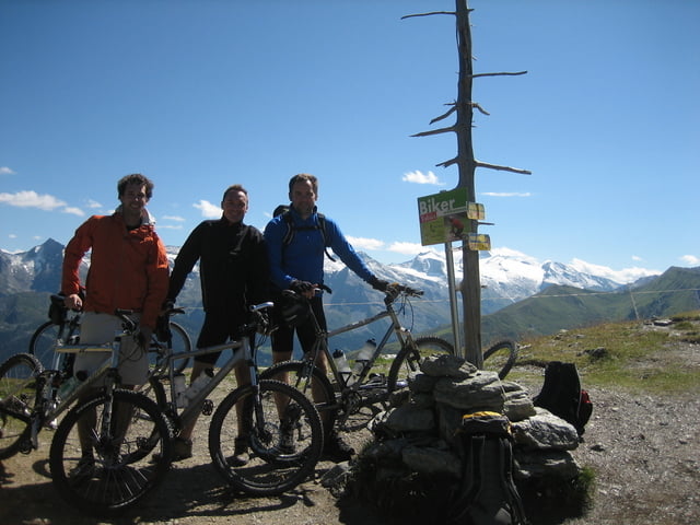
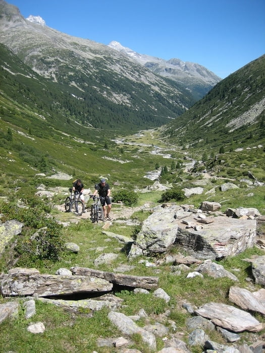
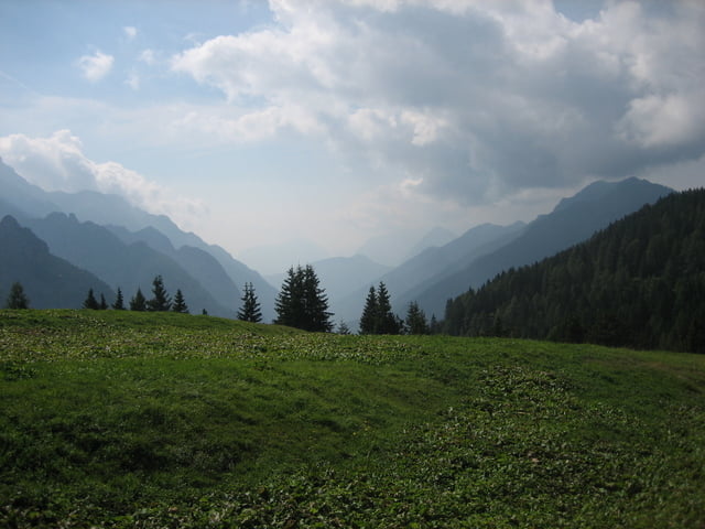
galéria trás

Mapa trasy a výškový profil
Minimum height 79 m
Maximum height 2296 m
More about the tour author

|
churchner74 |
komentáre

GPS trasy
Trackpoints-
GPX / Garmin Map Source (gpx) download
-
TCX / Garmin Training Center® (tcx) download
-
CRS / Garmin Training Center® (crs) download
-
Google Earth (kml) download
-
G7ToWin (g7t) download
-
TTQV (trk) download
-
Overlay (ovl) download
-
Fugawi (txt) download
-
Kompass (DAV) Track (tk) download
-
list trasy (pdf) download
-
Original file of the author (gpx) download
More about the tour author
|
|
churchner74 |
Add to my favorites
Remove from my favorites
Edit tags
Open track
My score
Rate