Login

Zabudli ste prihlasovacia meno

Cookies have to be accepted!
Your browser's cookie functionality is disabled. Please enable this functionality.

Not a member yet?

Register now
Login

Available for registred users only

Log in to use this feature.

Zabudli ste prihlasovacia meno

Cookies have to be accepted!
Your browser's cookie functionality is disabled. Please enable this functionality.

Not a member yet?

Register now
Filter
Kategórie
Advanced filters
  • Dĺžka (km)
  • výškomer
Uložiť filter Reset filter

TrackRank

QRCode

Technical data

Dĺžka61,2 km výškomer598 m Way down583 m Doba01:40 h:m dátum06.09.2008
ohodnotenia Author Kraj pôžitok z túry kondícia technika

štatistika

592 náhľady 1 ohodnotenie 80 Stiahnutia 4.00 priemer
Rate
  • list trasy
  • príjazd
  • Stiahnutia

Aufzeichnung der Tour vom 27.8.

Schöne Tour über viele kleine Nebenstrassen

Gefahren wurde in der ersten Gruppe ein Schnitt von 28km/h.

Mehr Info siehe Link

Further information at

http://www.forum-allgaeu.de/de/seite/aktionen/AKTIONEN.php

Mapa trasy a výškový profil

  • Open Street Map
  • Google
Minimum height 666 m Maximum height 859 m Detailný pohľad

More about the tour author

doweb
Member since 2005

Send private message

komentáre

Chorge on 11.07.2011

Wirklich schöne Runde!

Bin heute einen Teil der Runde gefahren. Aus Zeitmangel musste ich leider über Kraftisried/Günzach direkt abkürzen, und bin dafür dann auf dem Rückweg ab Wildpoldsried über Betzigau nach Kempten gefahren...
Die Runde hat so etwa 45km und ca. 470hm ergeben. Mit den 28km/h Durchschnitt kann ich nicht mithalten - bei mir waren es grad mal 25 mit Mühe. NEID!!!
Danke für die Tour - ich werde sie alsbald mal komplett abradeln!

LG Jörg
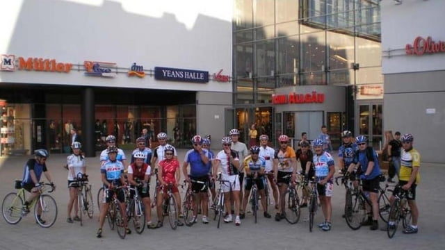
Kempten - Stadtmitte - Einkaufszentrum Forum - Treffpunkt am Haupteingang

GPS trasy

Trackpoints
  • GPX / Garmin Map Source (gpx) download
  • TCX / Garmin Training Center® (tcx) download
  • CRS / Garmin Training Center® (crs) download
  • Google Earth (kml) download
  • G7ToWin (g7t) download
  • TTQV (trk) download
  • Overlay (ovl) download
  • Fugawi (txt) download
  • Kompass (DAV) Track (tk) download
  • list trasy (pdf) download
  • Original file of the author (gpx) download

More about the tour author

doweb
Member since 2005

Send private message
Share track
Add to my favorites
Remove from my favorites
Edit tags
My score
Rate
trasa: Forum Radler
Druh: pretekársky bicykel
Dĺžka: 61,2 km
Evaluated on:
Doba:
Day(s)
Hour(s)
Minute(s)
ohodnotenie: Kraj pôžitok z túry kondícia technika