


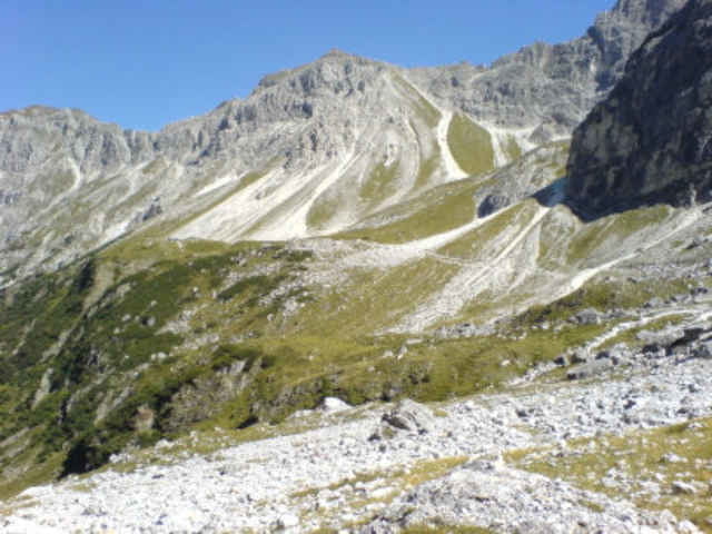
Vorbei am Gasthaus Feuerstein, nach ein paar Metern fährt man links vom Asphaltweg ab (Holzschild: Tribulaun Hütte)Anfangs geht der Weg im Wald (ca 1/4 der Strecke) mit wenig Schotter. Nach ca 5km ist der Weg sehr schottrig und dann recht steil sodaß man ein paar Höhenmeter schieben muß.Weiter oben geht es dann auf und ab zur Tribulaun Hütte . Wunderschöne Aussicht auf die Steilen Wände und auch Richtunf Geschnitztal und der Innsbrucker Hütte Durchschnittliche Steigung ca. 12%
galéria trás
Mapa trasy a výškový profil
Minimum height 1257 m
Maximum height 2082 m
More about the tour author
|
|
tomi |
komentáre
Man fährt gan hinein ins Geschnitztal, ein paar 100m vor dem Busumkehrplatz bzw. Gasthaus Feuerstein gibt es gratis Parkplätze.Von hier Starten wir
GPS trasy
Trackpoints-
GPX / Garmin Map Source (gpx) download
-
TCX / Garmin Training Center® (tcx) download
-
CRS / Garmin Training Center® (crs) download
-
Google Earth (kml) download
-
G7ToWin (g7t) download
-
TTQV (trk) download
-
Overlay (ovl) download
-
Fugawi (txt) download
-
Kompass (DAV) Track (tk) download
-
list trasy (pdf) download
-
Original file of the author (gpx) download
More about the tour author
|
|
tomi |
Add to my favorites
Remove from my favorites
Edit tags
Open track
My score
Rate
Tribulaun Hütte