Login

Zabudli ste prihlasovacia meno

Cookies have to be accepted!
Your browser's cookie functionality is disabled. Please enable this functionality.

Not a member yet?

Register now
Login

Available for registred users only

Log in to use this feature.

Zabudli ste prihlasovacia meno

Cookies have to be accepted!
Your browser's cookie functionality is disabled. Please enable this functionality.

Not a member yet?

Register now
Filter
Kategórie
Advanced filters
  • Dĺžka (km)
  • výškomer
Uložiť filter Reset filter

TrackRank

QRCode

Technical data

Dĺžka35,9 km výškomer366 m Way down372 m Doba02:30 h:m dátum26.09.2005
ohodnotenia Author Kraj pôžitok z túry kondícia technika

štatistika

4305 náhľady 1 ohodnotenie 283 Stiahnutia 1.00 priemer
Rate
  • list trasy
  • príjazd
  • Stiahnutia
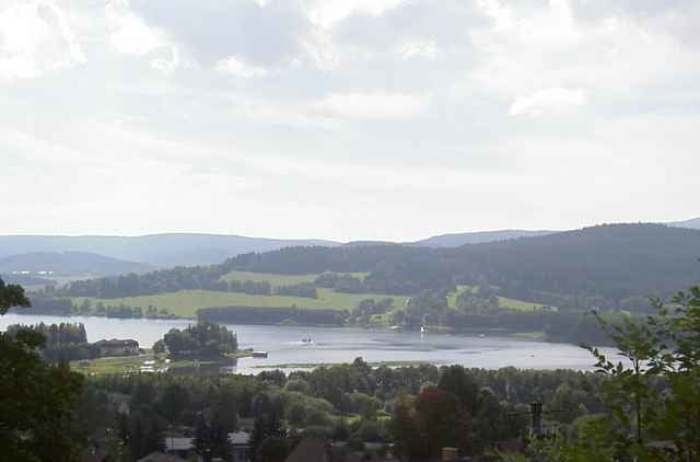
Eigentlich spielt sich die ganze Tour in CZ ab, nur der Start ist im M/4. Also Grenze in Schöneben überqueren. Mit einer Fähre setzt man um 1 EUR nach Horni Planá über. Im Ort steht das Stiftergeburtshaus inkl. Museum. Links halten und auf der Straße und Radweg (Nr. 33) bis nach Nová Pec. Nach überqueren der Moldau links einbiegen (Restaurant Oase). Jetzt Radweg 1033 folgen und entlang dem Schwemmkanal wieder zurück Richtung Grenze. Reisepass nicht vergessen!!

Further information at

http://lesr.info/bike

Mapa trasy a výškový profil

  • Open Street Map
  • Google
Minimum height 731 m Maximum height 949 m Detailný pohľad

More about the tour author

veste
Member since 2004

Send private message

komentáre

hosť on 10.10.2005

Restaurant zum Fuchs Nova Pec

Kann nur davor warnen dort einzukehren, Koechin= Alkoholikerin
Kellner verschmiert,

Essen ungeniessbar

Fermin
Irgendwie nach Schöneben (= Ulrichsberg -> Langlaufzentrum) gelangen.

GPS trasy

Trackpoints
  • GPX / Garmin Map Source (gpx) download
  • TCX / Garmin Training Center® (tcx) download
  • CRS / Garmin Training Center® (crs) download
  • Google Earth (kml) download
  • G7ToWin (g7t) download
  • TTQV (trk) download
  • Overlay (ovl) download
  • Fugawi (txt) download
  • Kompass (DAV) Track (tk) download
  • list trasy (pdf) download
  • Original file of the author (g7t) download

More about the tour author

veste
Member since 2004

Send private message
Share track
Add to my favorites
Remove from my favorites
Edit tags
My score
Rate
trasa: Schöneben - Moldaustausee - Schwemmkanal
Druh: trekingové bicykle
Dĺžka: 35,9 km
Evaluated on:
Doba:
Day(s)
Hour(s)
Minute(s)
ohodnotenie: Kraj pôžitok z túry kondícia technika