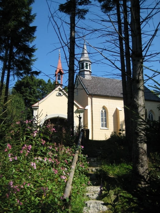
Ausgangspunkt ist die Sportanlage in Frauenzell. Wir wandern in südöstlicher Richtung auf wenig befahrenen Strassen zum Weiler Rungatshofen. Hier biegen wir links ab und gehen stetig ansteigend weiter nach Maggmannshofen. Wir folgen der Beschilderung nach Gschnait und biegen am Waldrand rechts ab auf einen unbefestigten Waldweg bis zum Anfang des Kreuzweges wo auch der Brunnen steht, dem heilende Kräfte nachgesagt werden.Von hier aus, auf dem Kreuzweg, steil bergauf zur Kirche, neben der auch noch die alte Holzkapelle steht. Nach Besichtigung der beiden "Schmuckstücke" und eventueller Einkehr im einzigen Gasthaus geht es weiter den "Langen Steig" hoch und durch den Wald hinunter nach Vorderbrennberg. Nach gut 1 Km erreichen wir wieder Rungathofen und von hier aus wieder auf gleichem Wege zurück nach Frauenzell.
galéria trás
Mapa trasy a výškový profil
Minimum height 729 m
Maximum height 900 m
komentáre

Frauenzell liegt im Kreis Oberallgäu, ca. 7 km von Leutkirch entfernt Richtung Kimratshofen.
GPS trasy
Trackpoints-
GPX / Garmin Map Source (gpx) download
-
TCX / Garmin Training Center® (tcx) download
-
CRS / Garmin Training Center® (crs) download
-
Google Earth (kml) download
-
G7ToWin (g7t) download
-
TTQV (trk) download
-
Overlay (ovl) download
-
Fugawi (txt) download
-
Kompass (DAV) Track (tk) download
-
list trasy (pdf) download
-
Original file of the author (gpx) download
Add to my favorites
Remove from my favorites
Edit tags
Open track
My score
Rate


