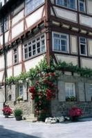
Der Leudelsbach ist ein kleiner Bach westlich von Ludwigsburg. Er ist ein für das Strohgäu typischer Bach und entsteht im Ortsgebiet von Möglingen. Auf seinem Weg zur Enz fließt er an Markgröningen, Asperg und Tamm vorbei. Die Gesamtlänge des Leudelsbachs beträgt 6.5 km.
Er mündet zwischen Unterrixingen und Untermberg in die Enz.
Further information at
http://www.markgroeningen.de/galéria trás
Mapa trasy a výškový profil
Minimum height 180 m
Maximum height 307 m
komentáre
Die Tour startet und endet in Freiberg a.N. bei der Lugaufhalle
GPS trasy
Trackpoints-
GPX / Garmin Map Source (gpx) download
-
TCX / Garmin Training Center® (tcx) download
-
CRS / Garmin Training Center® (crs) download
-
Google Earth (kml) download
-
G7ToWin (g7t) download
-
TTQV (trk) download
-
Overlay (ovl) download
-
Fugawi (txt) download
-
Kompass (DAV) Track (tk) download
-
list trasy (pdf) download
-
Original file of the author (gpx) download
Add to my favorites
Remove from my favorites
Edit tags
Open track
My score
Rate


schöne Tour!