Login

Zabudli ste prihlasovacia meno

Cookies have to be accepted!
Your browser's cookie functionality is disabled. Please enable this functionality.

Not a member yet?

Register now
Login

Available for registred users only

Log in to use this feature.

Zabudli ste prihlasovacia meno

Cookies have to be accepted!
Your browser's cookie functionality is disabled. Please enable this functionality.

Not a member yet?

Register now
Filter
Kategórie
Advanced filters
  • Dĺžka (km)
  • výškomer
Uložiť filter Reset filter

TrackRank

QRCode

Technical data

Dĺžka34,6 km výškomer85 m Way down106 m Doba01:30 h:m dátum26.10.2008
ohodnotenia Author Kraj pôžitok z túry kondícia technika

štatistika

1013 náhľady ohodnotenia 122 Stiahnutia priemer
Rate
  • list trasy
  • príjazd
  • Stiahnutia

Strecke zum Heizen... :)

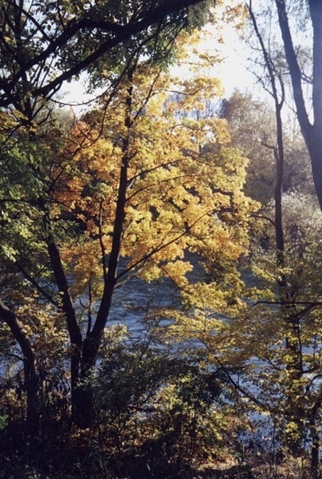
Den Lech vom Hochablass aus flussaufärts immer am Ufer entlang. Nicht den bekiesten Weg oberhalb, der ist langweilig und es sind dort zuviele Leute unterwegs.

Der Uferweg ist relativ einfach zu befahren und jetzt im Herbst macht das richtig Spass! Der Fahrweg geht bis zur Lechstaustufe 23 die wird überquert und dann führt einen der Weg flussabwärts am Ufer entlang wieder zurück zum Hochablass. Auf dem Rückweg gibt es sogar eine Tragestrecke mit 10-12 hm und einen kleinen Zufluss zum Lech die beide überwunden werden müßen.

Mapa trasy a výškový profil

  • Open Street Map
  • Google
Minimum height 469 m Maximum height 530 m Detailný pohľad

More about the tour author

Pointer
Member since 2008

Send private message

komentáre

strandet on 15.09.2011

Klasse

Hi Pointer, eigentlich ohne große Erwartung in die Tour gegangen. Aber diese beiden Wege flussauf-und abwärts des Lechs machen richtig Spaß. Obwohl an einem Sonntag gefahren war alles relativ ruhig.
Klasse vielen Dank

GPS trasy

Trackpoints
  • GPX / Garmin Map Source (gpx) download
  • TCX / Garmin Training Center® (tcx) download
  • CRS / Garmin Training Center® (crs) download
  • Google Earth (kml) download
  • G7ToWin (g7t) download
  • TTQV (trk) download
  • Overlay (ovl) download
  • Fugawi (txt) download
  • Kompass (DAV) Track (tk) download
  • list trasy (pdf) download
  • Original file of the author (gpx) download

More about the tour author

Pointer
Member since 2008

Send private message
Share track
Add to my favorites
Remove from my favorites
Edit tags
My score
Rate
trasa: Lechhausen-Lechstaustufe 23 und zurück (Ufertrail)
Druh: horský bicykel
Dĺžka: 34,6 km
Evaluated on:
Doba:
Day(s)
Hour(s)
Minute(s)
ohodnotenie: Kraj pôžitok z túry kondícia technika