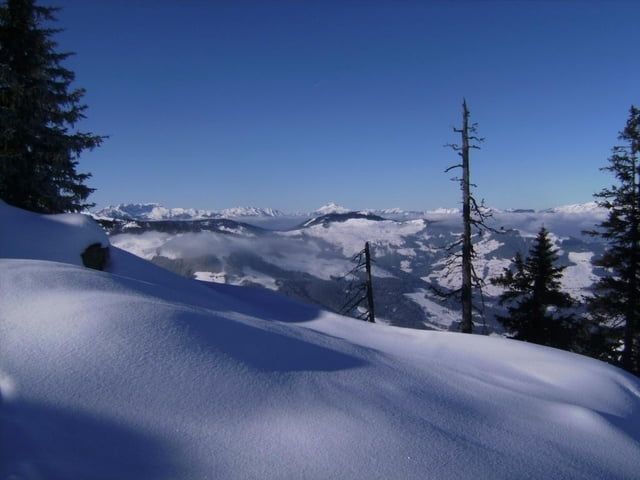
Ein Paradeskigipfel in den Kitzbüheler Bergen mit einer kleinen Fleißaufgabe.
Wir (über 30 Teilnehmer) gingen vom Gasthaus Jagerhäusl (ca. 820 m) im Windautal los. Bitte beim Wirt fragen, ob dort geparkt werden darf. Man hat nichts dagegen, wenn man anschließend dort einkehrt.
Zunächst geht es nach der Brücke rechts auf einer Forststraße flach in das sonnige Almgelände der Hartkaseralmen. Von dort zum Hartkaserjoch (1639 m) und links auf dem Rücken entlang über den Hundkopf (1836 m) zum Gipfel, 1925 m, reine Gehzeit gut 2 ½ Std. Da der Schnee eine vorzügliche Abfahrt Richtung Westen versprach, fuhren wir gut 300 Hm Richtung Kelchsau ab und stiegen dann nochmals zum Gipfel auf.
Die Abfahrt ins Tal begann für uns bis zum Hundskopf entlang der Aufstiegsspur und dann rechts Richtung Nordost über die Innere Hartkaseralm – Dreilichteralm zu dem engen Walddurchschlupf und weiter über freie Hänge bis zur Forststraße und auf der zurück zum PP. Eine Abfahrtsvariante war für einen Teil der Teilnehmer auch über den Steinberg direkt zum Gasthaus Steinberghaus möglich.
Further information at
http://www.gasthaus-steinberg.atgaléria trás
Mapa trasy a výškový profil
komentáre

GPS trasy
Trackpoints-
GPX / Garmin Map Source (gpx) download
-
TCX / Garmin Training Center® (tcx) download
-
CRS / Garmin Training Center® (crs) download
-
Google Earth (kml) download
-
G7ToWin (g7t) download
-
TTQV (trk) download
-
Overlay (ovl) download
-
Fugawi (txt) download
-
Kompass (DAV) Track (tk) download
-
list trasy (pdf) download
-
Original file of the author (gpx) download


