Login

Zabudli ste prihlasovacia meno

Cookies have to be accepted!
Your browser's cookie functionality is disabled. Please enable this functionality.

Not a member yet?

Register now
Login

Available for registred users only

Log in to use this feature.

Zabudli ste prihlasovacia meno

Cookies have to be accepted!
Your browser's cookie functionality is disabled. Please enable this functionality.

Not a member yet?

Register now
Filter
Kategórie
Advanced filters
  • Dĺžka (km)
  • výškomer
Uložiť filter Reset filter

TrackRank

QRCode

Technical data

Dĺžka56,0 km výškomer630 m Way down787 m Doba02:30 h:m dátum19.02.2009
ohodnotenia Author Kraj pôžitok z túry kondícia technika

štatistika

773 náhľady 2 ohodnotenia 98 Stiahnutia 4.50 priemer
Rate
  • list trasy
  • príjazd
  • Stiahnutia

Meine persönliche Haustour. Zum Anfang ein welliges aber trotzdem knackiges Profil, mit Steigungen von 6-12%, über den Königstuhl mit kurzer Trinkpause und zurück.

Orte:

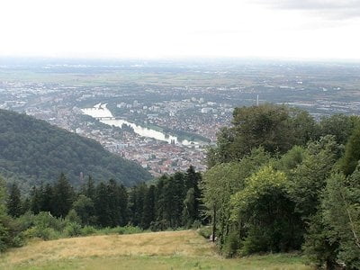
Brühl - Schwetzingen - Oftersheim - Sandhausen - Nussloch - Maisbach - Ochsenbach - Gauangeloch - Königstuhl - Heidelberg - Eppelheim - Plankstadt - Schwetzingen - Brühl

Mapa trasy a výškový profil

  • Open Street Map
  • Google
Minimum height 89 m Maximum height 561 m Detailný pohľad

More about the tour author

ManiacRider
Member since 2009

Send private message

komentáre

ThomasHeidelberg on 14.03.2009

Sehr schöne Tour

sehr schöne, abwechslungsreiche Tour über kleine Straßen und Wege

Danke, deine kleine Singletrailrunder ist auch sehr gut. leider sind wir sie rückwärts gefahren und am Anfang war diese sehr steil.
cyprien on 20.03.2009

Ist die Tour auch für MTB geeignet?

Hallo, wenn morgen das Wetter mitspielt, würd ich gerne mit meiner Freundin die erste Tour in diesem Jahr angehen. Ist die strecke auch etwas für MTB´s oder ist es überwiegend Asphalt auf dem man fährt?

Ich glaube zum Mountainbiken ist sie zu langweilig, es ist eine reine Rennradtour über Asphaltierte Straßen.

Gruß
Tobias

GPS trasy

Trackpoints
  • GPX / Garmin Map Source (gpx) download
  • TCX / Garmin Training Center® (tcx) download
  • CRS / Garmin Training Center® (crs) download
  • Google Earth (kml) download
  • G7ToWin (g7t) download
  • TTQV (trk) download
  • Overlay (ovl) download
  • Fugawi (txt) download
  • Kompass (DAV) Track (tk) download
  • list trasy (pdf) download
  • Original file of the author (gpx) download

More about the tour author

ManiacRider
Member since 2009

Send private message
Share track
Add to my favorites
Remove from my favorites
Edit tags
My score
Rate
trasa: Brühl - Königstuhl - Brühl
Druh: pretekársky bicykel
Dĺžka: 56,0 km
Evaluated on:
Doba:
Day(s)
Hour(s)
Minute(s)
ohodnotenie: Kraj pôžitok z túry kondícia technika