Login

Zabudli ste prihlasovacia meno

Cookies have to be accepted!
Your browser's cookie functionality is disabled. Please enable this functionality.

Not a member yet?

Register now
Login

Available for registred users only

Log in to use this feature.

Zabudli ste prihlasovacia meno

Cookies have to be accepted!
Your browser's cookie functionality is disabled. Please enable this functionality.

Not a member yet?

Register now
Filter
Kategórie
Advanced filters
  • Dĺžka (km)
  • výškomer
Uložiť filter Reset filter

TrackRank

QRCode

Technical data

Dĺžka62,0 km výškomer85 m Way down92 m Doba02:30 h:m dátum18.03.2009
ohodnotenia Author Kraj pôžitok z túry kondícia technika

štatistika

1415 náhľady ohodnotenia 113 Stiahnutia priemer
Rate
  • list trasy
  • príjazd
  • Stiahnutia

Von Bocholt über Werth immer auf Wirtschaftswegen nach Rees,

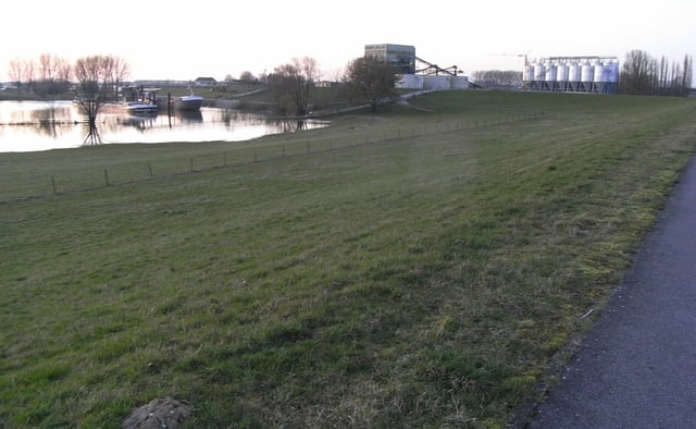
an Rheinauen und Rheinufer entlang geht es wunderschön gelegen meist über den Deich bis nach Bislich, von wo aus man auch weiterfahren könnte bis nach Wesel, wir aber - diemal über Loikum - zurückfahren nach Bocholt


galéria trás

Mapa trasy a výškový profil

  • Open Street Map
  • Google
Minimum height 7 m Maximum height 29 m Detailný pohľad

More about the tour author

schwaing
Member since 2008

Send private message

komentáre

Start ist Bocholt,

aber auch jeder andere Punkt kann als Ausgangspunkt genutzt werden.

Am schönsten ist der Anschnitt zwischen Rees und Bislich.

GPS trasy

Trackpoints
  • GPX / Garmin Map Source (gpx) download
  • TCX / Garmin Training Center® (tcx) download
  • CRS / Garmin Training Center® (crs) download
  • Google Earth (kml) download
  • G7ToWin (g7t) download
  • TTQV (trk) download
  • Overlay (ovl) download
  • Fugawi (txt) download
  • Kompass (DAV) Track (tk) download
  • list trasy (pdf) download
  • Original file of the author (gpx) download

More about the tour author

schwaing
Member since 2008

Send private message
Share track
Add to my favorites
Remove from my favorites
Edit tags
My score
Rate
trasa: bocholt rees bislich loikum
Druh: cykloturistika
Dĺžka: 62,0 km
Evaluated on:
Doba:
Day(s)
Hour(s)
Minute(s)
ohodnotenie: Kraj pôžitok z túry kondícia technika