Login

Zabudli ste prihlasovacia meno

Cookies have to be accepted!
Your browser's cookie functionality is disabled. Please enable this functionality.

Not a member yet?

Register now
Login

Available for registred users only

Log in to use this feature.

Zabudli ste prihlasovacia meno

Cookies have to be accepted!
Your browser's cookie functionality is disabled. Please enable this functionality.

Not a member yet?

Register now
Filter
Kategórie
Advanced filters
  • Dĺžka (km)
  • výškomer
Uložiť filter Reset filter

TrackRank

QRCode

Technical data

Dĺžka52,7 km výškomer0 m Way down0 m Doba05:00 h:m dátum20.04.2009
ohodnotenia Author Kraj pôžitok z túry kondícia technika

štatistika

1322 náhľady ohodnotenia 266 Stiahnutia priemer
Rate
  • list trasy
  • príjazd
  • Stiahnutia
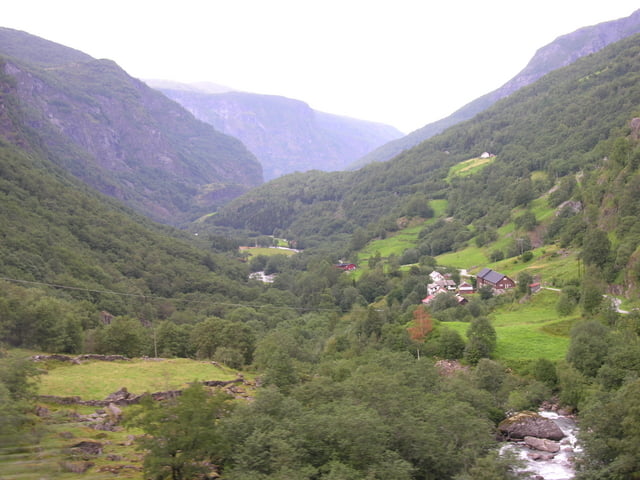
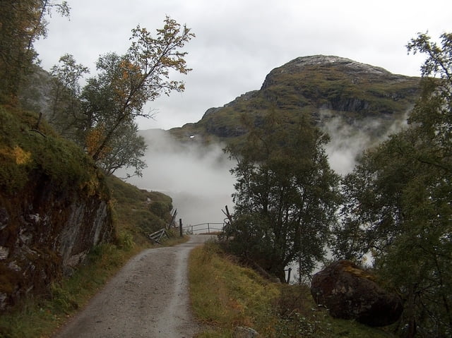
Vom Hafen und Bahnhof Flam fahren wir immer taleinwärts an Wasserfällen vorbei, durch Tunnels und steile Serpentinen bis nach Myrdal. Abzweig zum Bahnhof Myrdahl mit Möglichkeit zur Verpflegung. Dann zurück auf den Weg und weiter bis Finse auf einem ungeteerten Weg. Wunderschöne Gegend mit Seen und Fjäll. Die Serpentinen unterhalb Myrdahl sind sehr steil und schottrig und verlangen eine Portion Biss.

galéria trás

Mapa trasy a výškový profil

  • Open Street Map
  • Google
Minimum height 99999 m Maximum height -99999 m Detailný pohľad

More about the tour author

huelserhighway
Member since 2007

Send private message

komentáre

GPS trasy

Trackpoints
  • GPX / Garmin Map Source (gpx) download
  • TCX / Garmin Training Center® (tcx) download
  • CRS / Garmin Training Center® (crs) download
  • Google Earth (kml) download
  • G7ToWin (g7t) download
  • TTQV (trk) download
  • Overlay (ovl) download
  • Fugawi (txt) download
  • Kompass (DAV) Track (tk) download
  • list trasy (pdf) download
  • Original file of the author (gpx) download

More about the tour author

huelserhighway
Member since 2007

Send private message
Share track
Add to my favorites
Remove from my favorites
Edit tags
My score
Rate
trasa: von Flam nach Finse
Druh: horský bicykel
Dĺžka: 52,7 km
Evaluated on:
Doba:
Day(s)
Hour(s)
Minute(s)
ohodnotenie: Kraj pôžitok z túry kondícia technika