Login

Zabudli ste prihlasovacia meno

Cookies have to be accepted!
Your browser's cookie functionality is disabled. Please enable this functionality.

Not a member yet?

Register now
Login

Available for registred users only

Log in to use this feature.

Zabudli ste prihlasovacia meno

Cookies have to be accepted!
Your browser's cookie functionality is disabled. Please enable this functionality.

Not a member yet?

Register now
Filter
Kategórie
Advanced filters
  • Dĺžka (km)
  • výškomer
Uložiť filter Reset filter

TrackRank

QRCode

Technical data

Dĺžka80,6 km výškomer1113 m Way down1120 m Doba00:00 h:m dátum21.04.2009
ohodnotenia Author User Kraj pôžitok z túry kondícia technika

štatistika

863 náhľady 1 ohodnotenie 267 Stiahnutia 5.00 priemer
Rate
  • list trasy
  • príjazd
  • Stiahnutia

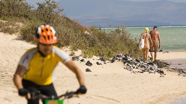
Diese Tour ist ursprünglich die Marathonstrecke  des alten Fuertebike Marathon, der jedes Jahr von Cilcomania organisiert wurde. Die Tour beginnt in Corralejo und führt zunächst die Küstenlinie entlang in Richtung Majanicho, und verläuft dann weiter ind Landesinnere. Da der Norden der Insel eher flach ist, muss man auch keine ernshaften Anstiege bewältigen, aber es kommen im Verlauf doch so einige Höhenmeter zusammen. Die Stecke an sich ist landschaftlich wenig abwechlunsgreich, aber für Mountainbiker ein sehr schöner Kurs, da man viele verschiedene Untergründe bewältigen muss, sprich von weich und sandig bis verblockt ist alles dabei.

Diese Strecke ist für Biker mit sehr guter Kondition und Fahrtechnik zu empfehlen.


Further information at

http://www.volcano-bike.de

Mapa trasy a výškový profil

  • Open Street Map
  • Google
Minimum height 6 m Maximum height 293 m Detailný pohľad

More about the tour author

empe_42
Member since 2009

Send private message

komentáre

Scipione on 12.03.2012

Empfehlung

Klasse Tour, sollte man unbedingt machen. GPS Daten passen perfekt. Sehr einsam, alles Piste. Der Landschaft würde ich mind. 1 Stern mehr geben.
Fully sehr empfehlenswert (habe bei easyriders in Corralejo gemietet, perfekter Service).

GPS trasy

Trackpoints
  • GPX / Garmin Map Source (gpx) download
  • TCX / Garmin Training Center® (tcx) download
  • CRS / Garmin Training Center® (crs) download
  • Google Earth (kml) download
  • G7ToWin (g7t) download
  • TTQV (trk) download
  • Overlay (ovl) download
  • Fugawi (txt) download
  • Kompass (DAV) Track (tk) download
  • list trasy (pdf) download
  • Original file of the author (gpx) download

More about the tour author

empe_42
Member since 2009

Send private message
Share track
Add to my favorites
Remove from my favorites
Edit tags
My score
Rate
trasa: fuerte-x-bike
Druh: horský bicykel
Dĺžka: 80,6 km
Evaluated on:
Doba:
Day(s)
Hour(s)
Minute(s)
ohodnotenie: Kraj pôžitok z túry kondícia technika