
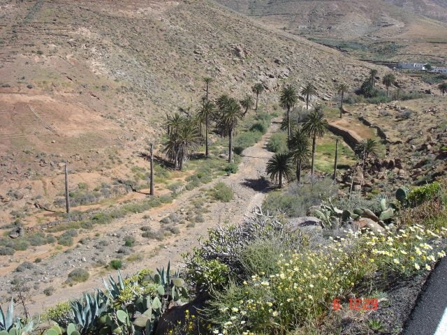

Diese Tour ist nicht sonderlich lang, aber dafür mit riesen Spassfaktor und landschaftlich einmalig. Eine Strecke für Leute die auch gern bergab fahren, aber technisch noch nicht so gut drauf sind. Ein Fully sollte man aber trotzdem fahren :-).Die Streckenführung hier verläuft auch teilweise auf der Strasse, kann aber auch komplett im Gelände gefahren werden. Man verlässt Betancuria und fährt gleich die nächste Möglichkeit rechts in den barranco. Hier gehts quasi immer parralel zur Srasse an Vega de Rio Palma vorbei und runter zum alten Stausee. Jetzt die kleine Schlucht (etwas technischer)runter und weiter nach Ajuy.
Wer lieber läuft, dem kann man diese Strecke aber auch als Wanderstrecke empfehlen.
Further information at
http://www.volcano-bike.degaléria trás


Mapa trasy a výškový profil
Minimum height 20 m
Maximum height 383 m
More about the tour author
|
|
empe_42 |
komentáre

Betancuria ist der am höchsten gelegene Ort der Insel und liegt im Herzen Fuerteventuras, im Tal der Tausend Palmen. Man erreicht Betancuria von Süden über Pajara , vom Norden über Antigua auf der FV-30.
GPS trasy
Trackpoints-
GPX / Garmin Map Source (gpx) download
-
TCX / Garmin Training Center® (tcx) download
-
CRS / Garmin Training Center® (crs) download
-
Google Earth (kml) download
-
G7ToWin (g7t) download
-
TTQV (trk) download
-
Overlay (ovl) download
-
Fugawi (txt) download
-
Kompass (DAV) Track (tk) download
-
list trasy (pdf) download
-
Original file of the author (gpx) download
More about the tour author
|
|
empe_42 |
Add to my favorites
Remove from my favorites
Edit tags
Open track
My score
Rate