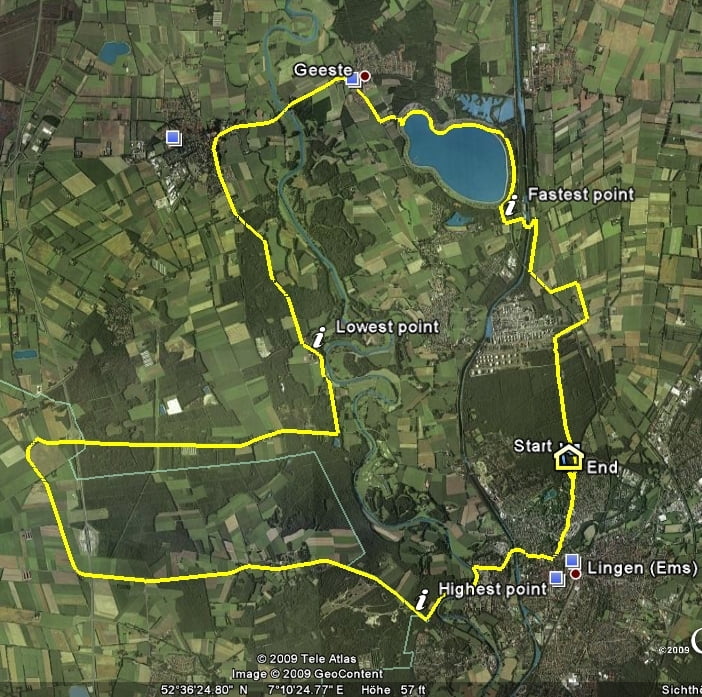
Genau das richtige um sich den noetigen Hunger vorm Sonntagsfruehstueck anzustrampeln. (....doch kauft die Broetchen vorher ein, sonst gibt's nichts mehr).
Die Tour ist nicht fuehrt an einem Speichersee vorbei, der im Notfall, falls der Dortmund-Ems-Kanal, oder die Ems selbst nicht genug Wasser fuehrt, das notwendige Kuehlwasser fuer die Kraftwerke bereitstellt. Das Speicherbecken wird ausserdem fuer Bade, Tauch und Segelaktivitaeten genutzt.
Further information at
http://www.lingen.degaléria trás
Mapa trasy a výškový profil
Minimum height 58 m
Maximum height 93 m
komentáre

Lingen, easy to find!
GPS trasy
Trackpoints-
GPX / Garmin Map Source (gpx) download
-
TCX / Garmin Training Center® (tcx) download
-
CRS / Garmin Training Center® (crs) download
-
Google Earth (kml) download
-
G7ToWin (g7t) download
-
TTQV (trk) download
-
Overlay (ovl) download
-
Fugawi (txt) download
-
Kompass (DAV) Track (tk) download
-
list trasy (pdf) download
-
Original file of the author (gpx) download
Add to my favorites
Remove from my favorites
Edit tags
Open track
My score
Rate


