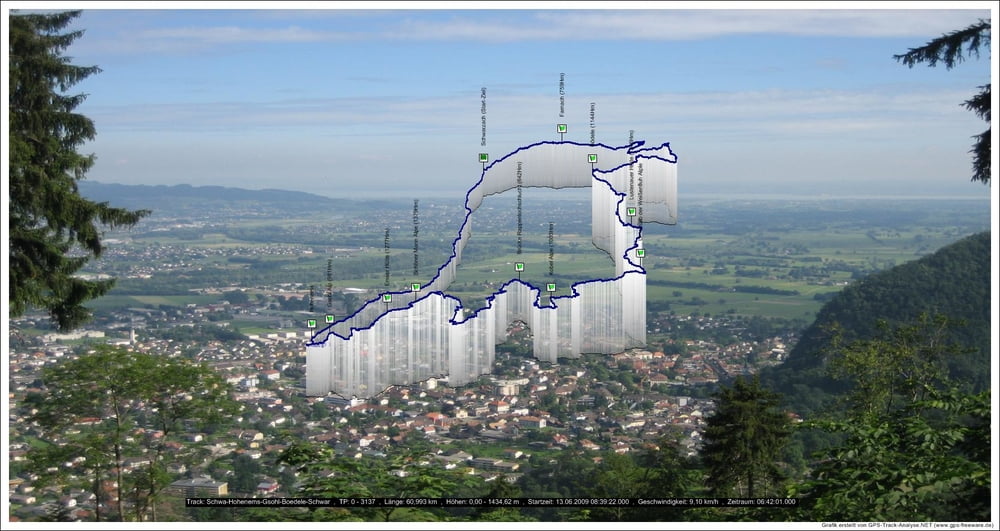
Bis Hohenems ist die Tour flach. Gsohl hinauf und dann weiter bis Schöner Mann Alpe geht es scharf Bergauf.Vom Ebnit bis zur Ebniterstraße gibt es für nicht Sattelfeste ein paar schiebe Meter. Vor der Bregenzer Hütte ist eine 100 Meter lange Rampe. Ist aber fahrbar. (Nach schlechtem Wetter vielleicht nicht)
Bewirtete Hütten:
Gsohl Alpe, Emser Hütte, Schöner Mann Alpe, Bregenzer Hütte, Lustenauer Hütte.galéria trás
Mapa trasy a výškový profil
Minimum height 411 m
Maximum height 1452 m
komentáre
Österreich: Autobahn A14, Dornbirn Nord ausfahren, Kreisverkehr grade aus, Richtung Bregenzerwald und Schwarzach, vor Tunnel links, Start in Schwarzach bei der Kirche
GPS trasy
Trackpoints-
GPX / Garmin Map Source (gpx) download
-
TCX / Garmin Training Center® (tcx) download
-
CRS / Garmin Training Center® (crs) download
-
Google Earth (kml) download
-
G7ToWin (g7t) download
-
TTQV (trk) download
-
Overlay (ovl) download
-
Fugawi (txt) download
-
Kompass (DAV) Track (tk) download
-
list trasy (pdf) download
-
Original file of the author (gpx) download
Add to my favorites
Remove from my favorites
Edit tags
Open track
My score
Rate


Hoi Klaus
Vielleicht trifft man sich ja mal zu einer Tour.
Bis bald Heinz
zur Zeit habe ich schlappe 70km in den Beinen. Für die Tour wird es noch nicht ganz reichen. Würde mcih freuen wenn sich ein paar Touren ausgehen. gruß Klaus