Login

Zabudli ste prihlasovacia meno

Cookies have to be accepted!
Your browser's cookie functionality is disabled. Please enable this functionality.

Not a member yet?

Register now
Login

Available for registred users only

Log in to use this feature.

Zabudli ste prihlasovacia meno

Cookies have to be accepted!
Your browser's cookie functionality is disabled. Please enable this functionality.

Not a member yet?

Register now
Filter
Kategórie
Advanced filters
  • Dĺžka (km)
  • výškomer
Uložiť filter Reset filter

TrackRank

QRCode

Technical data

Dĺžka69,2 km výškomer2596 m Way down2590 m Doba06:30 h:m dátum04.07.2009
ohodnotenia Author Kraj pôžitok z túry kondícia technika

štatistika

1983 náhľady 1 ohodnotenie 399 Stiahnutia 5.00 priemer
Rate
  • list trasy
  • príjazd
  • Stiahnutia

Riva - Limone - Vesio - S.Michele - Tremalzo - Pso. Nota - Pregasina - Riva

Die Tour ist eine Kombination der beiden Moser-Routen:

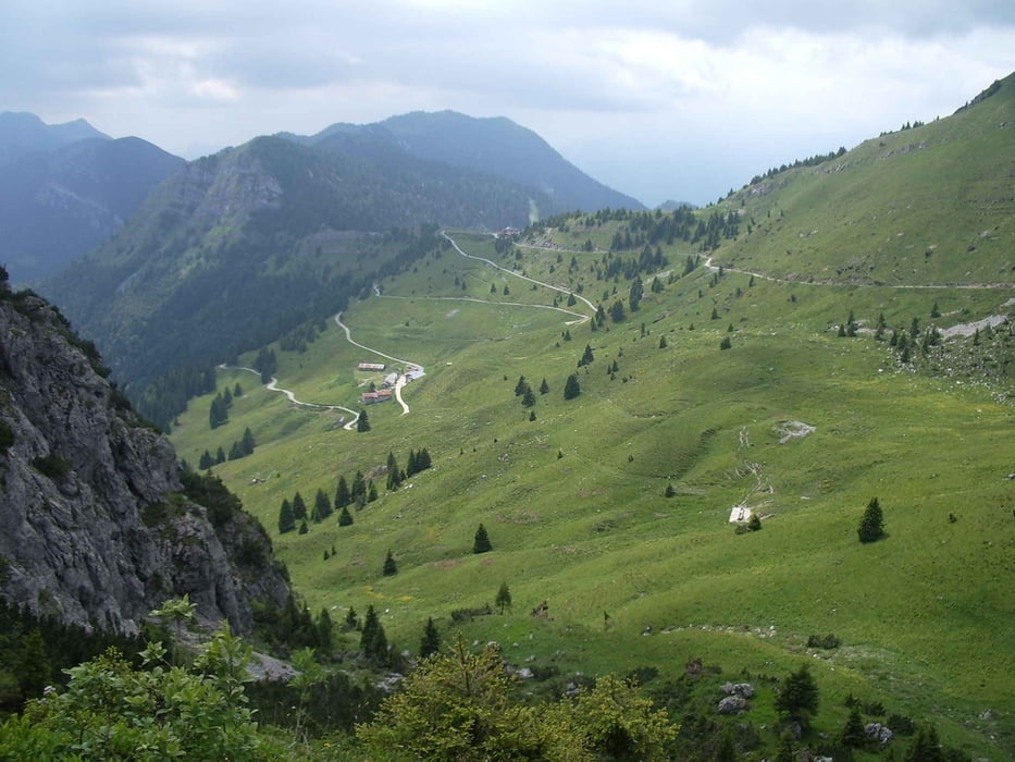
25 Tremalzo 2: Vesio, Valle S. Michele, Rifugio Garda, Pso. Nota

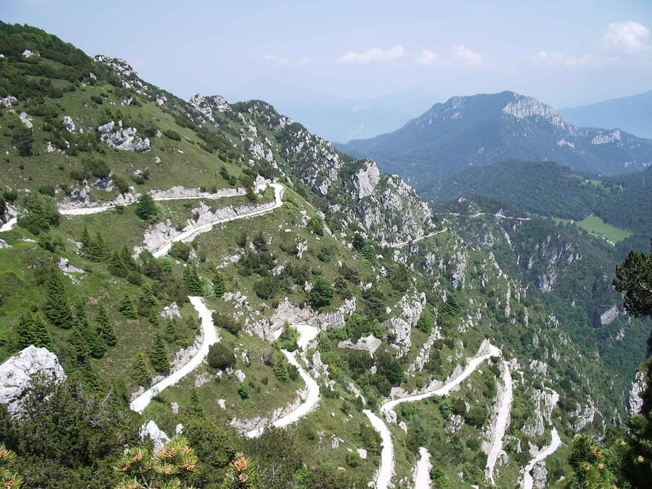
7 Tremalzo 1: Pso. Nota, Pso. Rochetta, Malga Palaer, Pregàsina, Riva

galéria trás

Mapa trasy a výškový profil

  • Open Street Map
  • Google
Minimum height 62 m Maximum height 1849 m Detailný pohľad

More about the tour author

wsbl54
Member since 2009

Send private message

komentáre

Start in Riva bei der Pizzeria S.Nicolo am Tunnel nach Torbole.

Überfahrt mit der Fähre von Torbole nach Limone.

Auffahrt auf Vehrkehrsstraßen bis Vesio.

GPS trasy

Trackpoints
  • GPX / Garmin Map Source (gpx) download
  • TCX / Garmin Training Center® (tcx) download
  • CRS / Garmin Training Center® (crs) download
  • Google Earth (kml) download
  • G7ToWin (g7t) download
  • TTQV (trk) download
  • Overlay (ovl) download
  • Fugawi (txt) download
  • Kompass (DAV) Track (tk) download
  • list trasy (pdf) download
  • Original file of the author (gpx) download

More about the tour author

wsbl54
Member since 2009

Send private message
Share track
Add to my favorites
Remove from my favorites
Edit tags
My score
Rate
trasa: Tremalzo
Druh: horský bicykel
Dĺžka: 69,2 km
Evaluated on:
Doba:
Day(s)
Hour(s)
Minute(s)
ohodnotenie: Kraj pôžitok z túry kondícia technika