
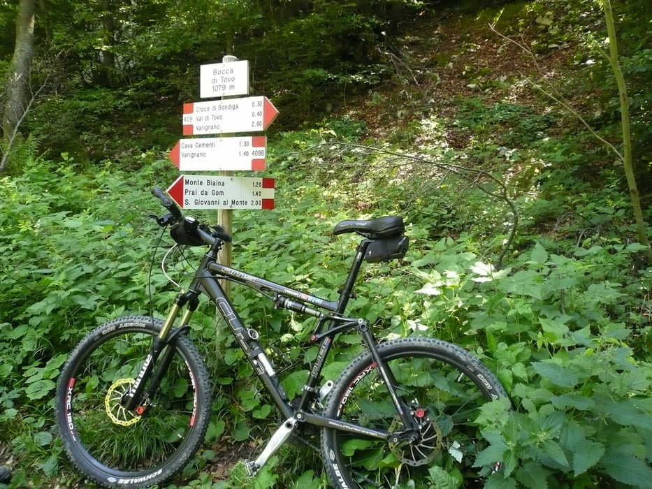

Wir starten von der "Vila Claudia" die Tour startet am Örtchen Viagnano Auffahrt Richtung San Giovanni. Zu Beginn geht es schweißtreibend auf Teer den Berg hinauf, wer will kann hier richtig Tempo machen (gell Fidi). Links in den Schotterweg (Schranke) einbiegen. Dort warten noch anstrengende Höhenmeter auf Schotter aber man wird mit sehr schönen Ausblicken auf den Gardasee belohnt. Noch nicht ganz oben biegt unscheinbar ein Weglein ein(Bocca di Tovo). Mit versenktem Sattel gehts gleich durch einen bockigen Pfad, der im Juni doch schon sehr verwachsen ist. Nachdem wir den ersten Teil des Trail hinter uns gebracht haben, geht es am Holzkreuz vorbei, (ja Rüdi nächstes mal fahren wir den Trail Richtung Arco, den du ja jetzt schon kennst!!)heute fahren wir weiter den breiten Fahrweg bis an die Steinmauer. Ab da gehts wieder einen tollen Trail hinunter. Der Rest ist schnell erzählt, wenn man sich nicht verliert(gell Edna)einfach hinunter bis Riva.
galéria trás


Mapa trasy a výškový profil
Minimum height 61 m
Maximum height 1065 m
More about the tour author

|
scherer1711 |
komentáre

GPS trasy
Trackpoints-
GPX / Garmin Map Source (gpx) download
-
TCX / Garmin Training Center® (tcx) download
-
CRS / Garmin Training Center® (crs) download
-
Google Earth (kml) download
-
G7ToWin (g7t) download
-
TTQV (trk) download
-
Overlay (ovl) download
-
Fugawi (txt) download
-
Kompass (DAV) Track (tk) download
-
list trasy (pdf) download
-
Original file of the author (gpx) download
More about the tour author
|
|
scherer1711 |
Add to my favorites
Remove from my favorites
Edit tags
Open track
My score
Rate