Login

Zabudli ste prihlasovacia meno

Cookies have to be accepted!
Your browser's cookie functionality is disabled. Please enable this functionality.

Not a member yet?

Register now
Login

Available for registred users only

Log in to use this feature.

Zabudli ste prihlasovacia meno

Cookies have to be accepted!
Your browser's cookie functionality is disabled. Please enable this functionality.

Not a member yet?

Register now
Filter
Kategórie
Advanced filters
  • Dĺžka (km)
  • výškomer
Uložiť filter Reset filter

TrackRank

QRCode

Technical data

Dĺžka16,5 km výškomer662 m Way down1818 m Doba06:00 h:m dátum07.07.2009
ohodnotenia Author User Kraj pôžitok z túry kondícia technika

štatistika

4506 náhľady 4 ohodnotenia 281 Stiahnutia 5.00 priemer
Rate
  • list trasy
  • príjazd
  • Stiahnutia

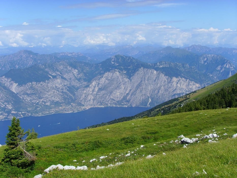
Sehr schwere Bergtour durch hochalpines Gelände von der Gipfelstation des Monte Baldo (1738 m) zur Cima Valdritta (2218 m) und dann Abstieg zur Mittelstation der Seilbahn.

Hierbei müssen ca. 800 Hm bergauf und ca. 1700 Hm bergab in teils sehr ausgesetztem Gelände welches mit vielen Stufen und losem Geröll überseht ist überwunden werden!

Die Tour ist nur für absolut trittsichere und schwindelfreie Personen geeignet !

Der Track läuft bei Abstieg vom Cima Valdritta kurz teilweise neben dem Wanderweg,da aufgrund von Schneefeldern eine Begehung des Weges nicht möglich war.

Auf der ganzen Tour gibt es keine Verpflegungsmöglichkeit.

Unter der Zeitangabe ist die reine Gehzeit ohne Pausen angegeben.

Further information at

http://www.funiviedelbaldo.it/ger/seilbahn_malcesine.asp

galéria trás

Mapa trasy a výškový profil

  • Open Street Map
  • Google
Minimum height 585 m Maximum height 2215 m Detailný pohľad

More about the tour author

blautalbiker
Member since 2007

Send private message

komentáre

Die Talstation befindet sich in Malcesine und ist (Beschildert) leicht zu finden.

GPS trasy

Trackpoints
  • GPX / Garmin Map Source (gpx) download
  • TCX / Garmin Training Center® (tcx) download
  • CRS / Garmin Training Center® (crs) download
  • Google Earth (kml) download
  • G7ToWin (g7t) download
  • TTQV (trk) download
  • Overlay (ovl) download
  • Fugawi (txt) download
  • Kompass (DAV) Track (tk) download
  • list trasy (pdf) download
  • Original file of the author (gpx) download

More about the tour author

blautalbiker
Member since 2007

Send private message
Share track
Add to my favorites
Remove from my favorites
Edit tags
My score
Rate
trasa: Monte Baldo - Cima Valdritta
Druh: horská trasa
Dĺžka: 16,5 km
Evaluated on:
Doba:
Day(s)
Hour(s)
Minute(s)
ohodnotenie: Kraj pôžitok z túry kondícia technika