Login

Zabudli ste prihlasovacia meno

Cookies have to be accepted!
Your browser's cookie functionality is disabled. Please enable this functionality.

Not a member yet?

Register now
Login

Available for registred users only

Log in to use this feature.

Zabudli ste prihlasovacia meno

Cookies have to be accepted!
Your browser's cookie functionality is disabled. Please enable this functionality.

Not a member yet?

Register now
Filter
Kategórie
Advanced filters
  • Dĺžka (km)
  • výškomer
Uložiť filter Reset filter

TrackRank

QRCode

Technical data

Dĺžka54,3 km výškomer1428 m Way down1447 m Doba00:00 h:m dátum30.06.2006
ohodnotenia Author User Kraj pôžitok z túry kondícia technika

štatistika

4095 náhľady 1 ohodnotenie 640 Stiahnutia 4.00 priemer
Rate
  • list trasy
  • príjazd
  • Stiahnutia
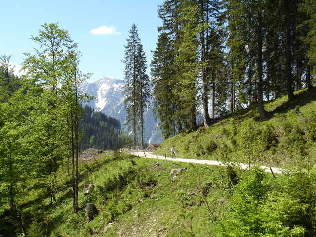
Umrundung des markanten Guffert mit schönen Ausblicken von der Gufferthütte und später bei der Abfahrt ins Tal der Brandenberger Ache.

Mapa trasy a výškový profil

  • Open Street Map
  • Google
Minimum height 684 m Maximum height 1472 m Detailný pohľad

More about the tour author

mtbbiker

komentáre

B 13 München, Achenpaß nach Achenwald

GPS trasy

Trackpoints
  • GPX / Garmin Map Source (gpx) download
  • TCX / Garmin Training Center® (tcx) download
  • CRS / Garmin Training Center® (crs) download
  • Google Earth (kml) download
  • G7ToWin (g7t) download
  • TTQV (trk) download
  • Overlay (ovl) download
  • Fugawi (txt) download
  • Kompass (DAV) Track (tk) download
  • list trasy (pdf) download
  • Original file of the author (gpx) download

More about the tour author

mtbbiker

Share track
Add to my favorites
Remove from my favorites
Edit tags
My score
Rate
trasa: Rund um den Guffert
Druh: horský bicykel
Dĺžka: 54,3 km
Evaluated on:
Doba:
Day(s)
Hour(s)
Minute(s)
ohodnotenie: Kraj pôžitok z túry kondícia technika