
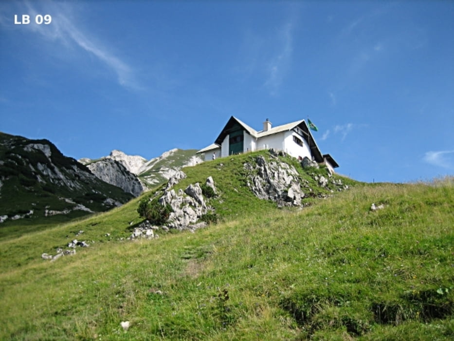

Die Wanderung zum Admonterhaus beginnt am Parkplatz direkt beim Buchauersattel auf 885m. Der Buchauersattel liegt zwischen Admont und St. Gallen in der schönen steirischen Region Gesäuse. Auf dem ersten Teil der Wanderung führt ein Forstweg zum Grabneralm Haus und es sind noch keine Wanderschuhe erforderlich. Für den Wanderweg vom Grabneralm Haus zum Admonterhaus sind feste Wanderschuhe aber sehr empfehlenswert. Die Wandertour bis zur Grabneralm ist für Kinder ab ca. 8 Jahre und der Wanderweg auf das Admonterhaus ab ca. 12 Jahren geeignet. Bis zur Grabneralm geht man ca. 1,5 Stunden und von der Grabneralm zum Admonterhaus etwa 45 min. Mit den Pausen dauert diese Wanderung ca. 5-6 Stunden.
Weitere Infos und Fotos zur Wanderung auf die Grabneralm und Admonterhaus findest du auf
biketours4you.at
Mapa trasy a výškový profil
Minimum height 878 m
Maximum height 1818 m
More about the tour author
|
|
Trek1400d |
komentáre

GPS trasy
Trackpoints-
GPX / Garmin Map Source (gpx) download
-
TCX / Garmin Training Center® (tcx) download
-
CRS / Garmin Training Center® (crs) download
-
Google Earth (kml) download
-
G7ToWin (g7t) download
-
TTQV (trk) download
-
Overlay (ovl) download
-
Fugawi (txt) download
-
Kompass (DAV) Track (tk) download
-
list trasy (pdf) download
-
Original file of the author (gpx) download
More about the tour author
|
|
Trek1400d |
Add to my favorites
Remove from my favorites
Edit tags
Open track
My score
Rate