Login

Zabudli ste prihlasovacia meno

Cookies have to be accepted!
Your browser's cookie functionality is disabled. Please enable this functionality.

Not a member yet?

Register now
Login

Available for registred users only

Log in to use this feature.

Zabudli ste prihlasovacia meno

Cookies have to be accepted!
Your browser's cookie functionality is disabled. Please enable this functionality.

Not a member yet?

Register now
Filter
Kategórie
Advanced filters
  • Dĺžka (km)
  • výškomer
Uložiť filter Reset filter

TrackRank

QRCode

Technical data

Dĺžka65,7 km výškomer1789 m Way down1796 m Doba06:35 h:m dátum03.09.2009
ohodnotenia Author User Kraj pôžitok z túry kondícia technika

štatistika

1548 náhľady 1 ohodnotenie 381 Stiahnutia 3.00 priemer
Rate
  • list trasy
  • príjazd
  • Stiahnutia

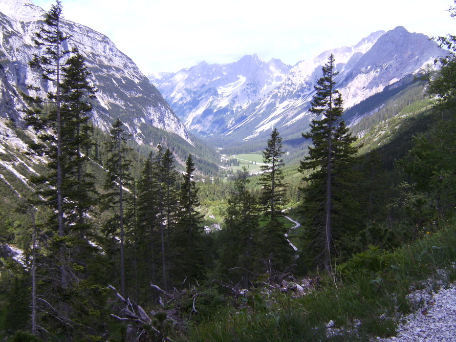
Traumhafte Runde ab Scharnitz durch das Karwendeltal zum Karwendelhaus. Von dort über den Hochalmsattel zum kleinen Ahornboden, wo wir aufgrund eines Schneefeldes den Weg zum Hermann-von-Barth-Denkmal nicht gleich fanden.

Weiter nach Hinterriß, wo wir eine Abfahrt früher Richtung Vereinalm abbogen und dadurch auf der linken Talseite bis nach Vordersbachau hoch kurbelten. Schöne Variante auf schmalem Pfad während die meisten Biker auf der rechten Talseite auf breiterem Schotterweg zu sehen waren. Die Durchquerung der Furt am Fermersbach war problemlos. Nach kurzer Rast auf der Vereinalm folgte die Abfahrt mit Blick auf Wettersteinspitze/ Zugspitzmassiv nach Mittenwald und dann zurück nach Scharnitz.

galéria trás

Mapa trasy a výškový profil

  • Open Street Map
  • Google
Minimum height 886 m Maximum height 1793 m Detailný pohľad

More about the tour author

heikespo
Member since 2009

Send private message

komentáre

Kostenpflichtiger Parktplatz in Scharnitz. Von der Hauptstraße Richtung Karwendeltäler/ Isartal abfahren

GPS trasy

Trackpoints
  • GPX / Garmin Map Source (gpx) download
  • TCX / Garmin Training Center® (tcx) download
  • CRS / Garmin Training Center® (crs) download
  • Google Earth (kml) download
  • G7ToWin (g7t) download
  • TTQV (trk) download
  • Overlay (ovl) download
  • Fugawi (txt) download
  • Kompass (DAV) Track (tk) download
  • list trasy (pdf) download
  • Original file of the author (gpx) download

More about the tour author

heikespo
Member since 2009

Send private message
Share track
Add to my favorites
Remove from my favorites
Edit tags
My score
Rate
trasa: Karwendelrunde
Druh: horský bicykel
Dĺžka: 65,7 km
Evaluated on:
Doba:
Day(s)
Hour(s)
Minute(s)
ohodnotenie: Kraj pôžitok z túry kondícia technika