


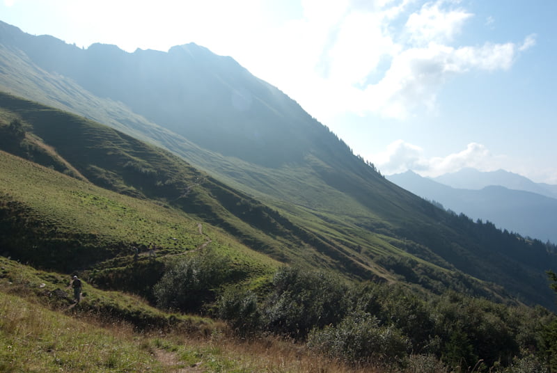
Unsere Tour startet an der Selbstversorgerhütte auf der Wiesa (www.maisaess.at) und geht über die Türtschalpe zur Unterdamülser Alpe. Dieser Abschnitt ist sehr gemütlich zu laufen und man hat einen permanenten Blick zum Glatthorn.
Von dort geht es erst mal 620hm straff bergauf bis zum Glatthorn. Der Abstieg ist etwas schwierig, da die Route nach Mittelberg ab dem Abzweig (ca.200m hinter dem Gipfel) kaum begangen wird. Am besten man orientiert sich an der neuen Alpe, denn diese ist auch der Einstieg. Von Mittelberg kann man dann ins Tal absteigen. Wir mussten aber wieder Richtung Türtschalpe, was dann noch mal 250hm bedeutete.
Diese Tour kann man auch gemütlich von Fontanelle, Mittelberg oder Sonntag aus starten, denn die Türtschalpe ist überall ausgeschildert.
galéria trás
Mapa trasy a výškový profil
Minimum height 1251 m
Maximum height 2132 m
More about the tour author

|
Fun-Riders |
komentáre

GPS trasy
Trackpoints-
GPX / Garmin Map Source (gpx) download
-
TCX / Garmin Training Center® (tcx) download
-
CRS / Garmin Training Center® (crs) download
-
Google Earth (kml) download
-
G7ToWin (g7t) download
-
TTQV (trk) download
-
Overlay (ovl) download
-
Fugawi (txt) download
-
Kompass (DAV) Track (tk) download
-
list trasy (pdf) download
-
Original file of the author (gpx) download
More about the tour author
|
|
Fun-Riders |
Add to my favorites
Remove from my favorites
Edit tags
Open track
My score
Rate