


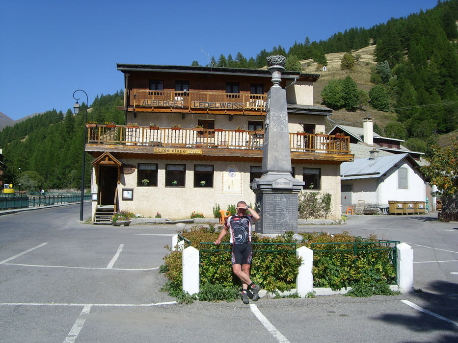
Von Sestriere zuerst auf kurvenreicher Straße bergab bis zum Weiler Champlas Du Col 1752m. Von dort auf sehr steilen Karrenweg hinab bis kurz vor Sauze Di Cesana 1560m. Danach auf der Sp215 bis Bousson 1421m und dann links in das Tal zum Col des Thures 2798m. Weiter geht es auf Starße bis Thures 1650m, ab dort Schotter und teilweise steile Flanken über die Weiler Rhuilles 1665m sowie Thuras 1952m auf immer gröberen Schotter bis zu Beginn der Schiebenpassage auf ca. 2200m. Von dort bis zum Gipfel Colle Di Thuras 2798m habe ich schiebend 1h40min benötigt. Die letzten 100 Höhenmeter zum Gipfel muste das Rad getragen werden. Danach gelegentlicher Dohnhill mit längeren Schiebepassagen bis nach La Montette auf ca. 2000m. Danach wunderschöne schnelle Abfahrt über Le Rouc nach Abries 1550m. Übernachtung im Auberge Hotel L'Edelweiss **. Durchschnittsgeschwindigkeit~8,0km/h
Further information at
http://www.abries-ristolas.com/sources/e-index.aspgaléria trás


Mapa trasy a výškový profil
Minimum height 1449 m
Maximum height 2805 m
More about the tour author
|
|
Sport2008 |
komentáre

siehe 1-Tag Westalpen - Fahrt nach Susa oder
Tour 45528
GPS trasy
Trackpoints-
GPX / Garmin Map Source (gpx) download
-
TCX / Garmin Training Center® (tcx) download
-
CRS / Garmin Training Center® (crs) download
-
Google Earth (kml) download
-
G7ToWin (g7t) download
-
TTQV (trk) download
-
Overlay (ovl) download
-
Fugawi (txt) download
-
Kompass (DAV) Track (tk) download
-
list trasy (pdf) download
-
Original file of the author (gpx) download
More about the tour author
|
|
Sport2008 |
Add to my favorites
Remove from my favorites
Edit tags
Open track
My score
Rate