


After having had a small problem with the GPS, half of the altitude values were lost. Will try to fix this later.
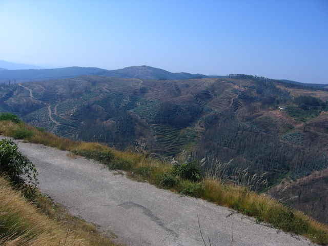
This is one of the most beautiful areas I know. The scenery is well worth the ride although some of the climbs take a fair bit of abuse on your muscles.
There are road signs aplenty even at the more remote areas. So Should you choose to cut the ride short for some reason, you'll be ok.
The top of the mountain is stunning. Riding under the wind turbines as you get to the top of the mountain is extremly satisfying. Expect cool air during summer months and snow or negative temperatures during winter.
galéria trás
Mapa trasy a výškový profil
Minimum height 185 m
Maximum height 764 m
More about the tour author

|
komentáre

GPS trasy
Trackpoints-
GPX / Garmin Map Source (gpx) download
-
TCX / Garmin Training Center® (tcx) download
-
CRS / Garmin Training Center® (crs) download
-
Google Earth (kml) download
-
G7ToWin (g7t) download
-
TTQV (trk) download
-
Overlay (ovl) download
-
Fugawi (txt) download
-
Kompass (DAV) Track (tk) download
-
list trasy (pdf) download
-
Original file of the author (gpx) download
More about the tour author
|
|
Add to my favorites
Remove from my favorites
Edit tags
Open track
My score
Rate