Login

Zabudli ste prihlasovacia meno

Cookies have to be accepted!
Your browser's cookie functionality is disabled. Please enable this functionality.

Not a member yet?

Register now
Login

Available for registred users only

Log in to use this feature.

Zabudli ste prihlasovacia meno

Cookies have to be accepted!
Your browser's cookie functionality is disabled. Please enable this functionality.

Not a member yet?

Register now
Filter
Kategórie
Advanced filters
  • Dĺžka (km)
  • výškomer
Uložiť filter Reset filter

TrackRank

QRCode

Technical data

Dĺžka19,3 km výškomer936 m Way down1176 m Doba06:50 h:m dátum15.09.2009
ohodnotenia Author Kraj pôžitok z túry kondícia technika

štatistika

866 náhľady 1 ohodnotenie 55 Stiahnutia 5.00 priemer
Rate
  • list trasy
  • príjazd
  • Stiahnutia
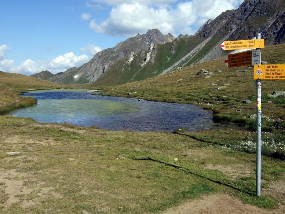
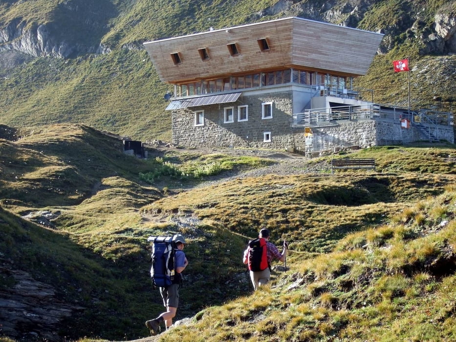
Von der Capanna Cristallina (2.568m) vorbei am Lago Sfundau und Lago Bianco nach Robiei (1.940m). Nach Westen Aufstieg zur Batta di Val Maggia (2.635m). Steiler Abstieg zum Laghi Boden (2.342m) und Übergang zum Passo San Giacomo (2.313m). Zur Kapelle San Giacomo (2.254m) und dann den Bergweg weiter nach Westen zur Capanna Corno Gries (2.338m). Hinweis: Die Tour wurde vom user Thomas_ ausgearbeitet und geführt.

galéria trás

Mapa trasy a výškový profil

  • Open Street Map
  • Google
Minimum height 1924 m Maximum height 2639 m Detailný pohľad

More about the tour author

rawajo
Member since 2009

Send private message

komentáre

siehe alpine Rundwanderung im Tessin (1.Etappe)

GPS trasy

Trackpoints
  • GPX / Garmin Map Source (gpx) download
  • TCX / Garmin Training Center® (tcx) download
  • CRS / Garmin Training Center® (crs) download
  • Google Earth (kml) download
  • G7ToWin (g7t) download
  • TTQV (trk) download
  • Overlay (ovl) download
  • Fugawi (txt) download
  • Kompass (DAV) Track (tk) download
  • list trasy (pdf) download
  • Original file of the author (gpx) download

More about the tour author

rawajo
Member since 2009

Send private message
Share track
Add to my favorites
Remove from my favorites
Edit tags
My score
Rate
trasa: Alpine Rundwanderung im Tessin (2.Etappe)
Druh: horská trasa
Dĺžka: 19,3 km
Evaluated on:
Doba:
Day(s)
Hour(s)
Minute(s)
ohodnotenie: Kraj pôžitok z túry kondícia technika