


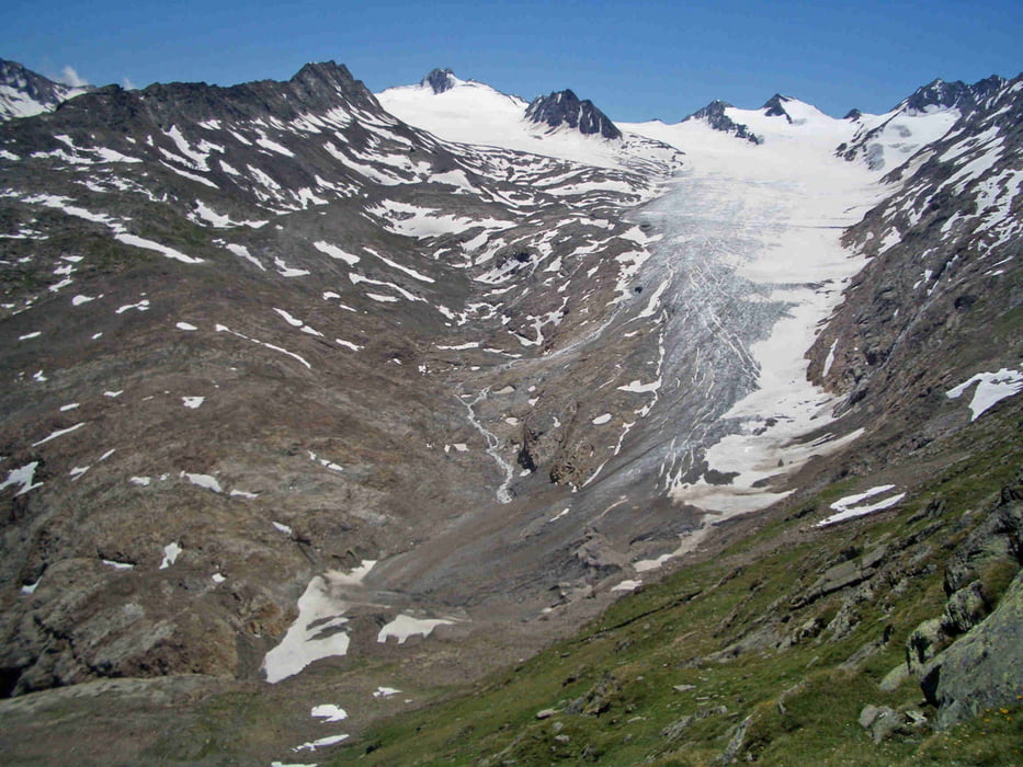
Von Obergurgl aus geht es langsam und zunächst flach dann steil ansteigend hinauf auf das in 3000 Meter Höhe gelegene Ramolhaus. Von dort den Weg ein Stück zurück und dann nach Rechts zum Gletscher hinab. Über eine Leiter gelangt man auf den Gletscher, der schräg nach oben gequert wird. Auf der anderen Seite erfolgt zunächst ein stetiger Aufstieg und dann ein steiler Abstieg. Über einen breiten Wanderweg geht es wieder Richtung Obergurgl. Die Tour ist technisch nicht sehr anspruchsvoll, durch die Länge verlangt sie aber doch etwas Kondition. Schöne Rastmöglichkeiten im Ramolhaus und der Karlsruher Hütte.
galéria trás


Mapa trasy a výškový profil
Minimum height 1895 m
Maximum height 3018 m
More about the tour author

|
stefan913 |
komentáre

GPS trasy
Trackpoints-
GPX / Garmin Map Source (gpx) download
-
TCX / Garmin Training Center® (tcx) download
-
CRS / Garmin Training Center® (crs) download
-
Google Earth (kml) download
-
G7ToWin (g7t) download
-
TTQV (trk) download
-
Overlay (ovl) download
-
Fugawi (txt) download
-
Kompass (DAV) Track (tk) download
-
list trasy (pdf) download
-
Original file of the author (gpx) download
More about the tour author
|
|
stefan913 |
Add to my favorites
Remove from my favorites
Edit tags
Open track
My score
Rate