Login

Zabudli ste prihlasovacia meno

Cookies have to be accepted!
Your browser's cookie functionality is disabled. Please enable this functionality.

Not a member yet?

Register now
Login

Available for registred users only

Log in to use this feature.

Zabudli ste prihlasovacia meno

Cookies have to be accepted!
Your browser's cookie functionality is disabled. Please enable this functionality.

Not a member yet?

Register now
Filter
Kategórie
Advanced filters
  • Dĺžka (km)
  • výškomer
Uložiť filter Reset filter

TrackRank

QRCode

Technical data

Dĺžka28,7 km výškomer1184 m Way down1040 m Doba03:00 h:m dátum08.10.2009
ohodnotenia Author Kraj pôžitok z túry kondícia technika

štatistika

436 náhľady ohodnotenia 56 Stiahnutia priemer
Rate
  • list trasy
  • príjazd
  • Stiahnutia
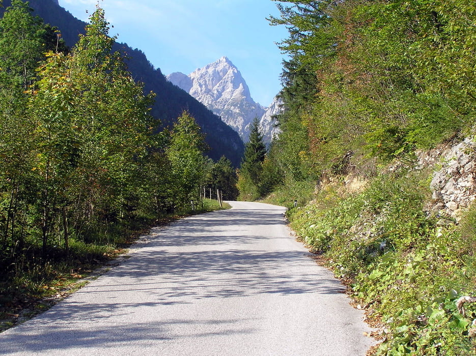
Lepa tura s čudovitimi razgledi na okoliške hribe. Do razgledne točke Logarska peč je 10 minut hoje.

galéria trás

Mapa trasy a výškový profil

  • Open Street Map
  • Google
Minimum height 515 m Maximum height 1538 m Detailný pohľad

More about the tour author

vito35
Member since 2008

Send private message

komentáre

GPS trasy

Trackpoints
  • GPX / Garmin Map Source (gpx) download
  • TCX / Garmin Training Center® (tcx) download
  • CRS / Garmin Training Center® (crs) download
  • Google Earth (kml) download
  • G7ToWin (g7t) download
  • TTQV (trk) download
  • Overlay (ovl) download
  • Fugawi (txt) download
  • Kompass (DAV) Track (tk) download
  • list trasy (pdf) download
  • Original file of the author (gpx) download

More about the tour author

vito35
Member since 2008

Send private message
Share track
Add to my favorites
Remove from my favorites
Edit tags
My score
Rate
trasa: Icmanikova planina
Druh: horský bicykel
Dĺžka: 28,7 km
Evaluated on:
Doba:
Day(s)
Hour(s)
Minute(s)
ohodnotenie: Kraj pôžitok z túry kondícia technika