


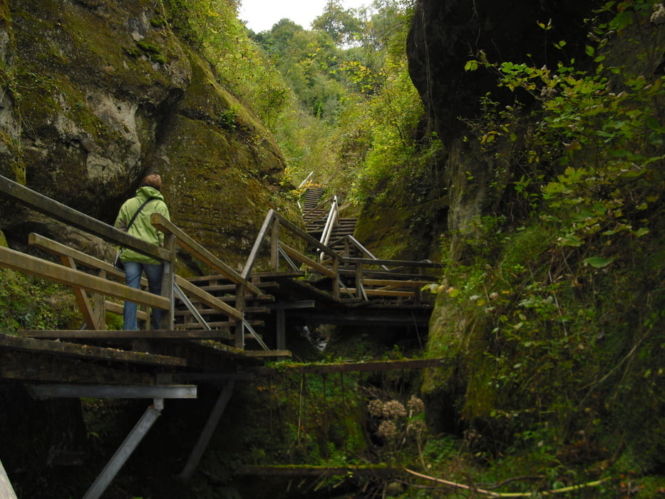
Rundwanderung am Steilufer vom Überlinger See mit Durchstieg der Marienschlucht. Start der Tour beim Gasthof Hof-Höfen zwischen Liggeringen und Langenrain. Vorbei am Bisongehege kommen wir zum Kloster Frauenberg. Hier gibts einen schönen Ausblick auf Überlinger See und die Ruine Altbodmann. Durch ein Waldstück teils steil abwärts kommen wir zum Schloss Gries bei Bodmann. Nun wandern wir entlang dem See zur Marienschlucht. Diese ist auf einer steilen Treppe in ihrer gesamten Länge begehbar. Oberhalb der Schlucht liegt die Burgruine Kargegg vorbei an dieser kommen wir zum Golfplatz und zurück nach Langenrain und Hof Höfen.
Die Tour kann auch vom Wanderparkplatz Kargegg oder aus Bodmann gestartet werden.
www.waldgasthaus-hof-hoefen.de
Further information at
http://www.marienschlucht.degaléria trás


Mapa trasy a výškový profil
Minimum height 388 m
Maximum height 753 m
More about the tour author
|
|
Bockrider |
komentáre

Von Konstanz auf auf L 220 Dettingen und Langenrain zum Hof Höfen. Von Bodmann auf K6100 nach Liggeringen und Hof Höfen.
GPS trasy
Trackpoints-
GPX / Garmin Map Source (gpx) download
-
TCX / Garmin Training Center® (tcx) download
-
CRS / Garmin Training Center® (crs) download
-
Google Earth (kml) download
-
G7ToWin (g7t) download
-
TTQV (trk) download
-
Overlay (ovl) download
-
Fugawi (txt) download
-
Kompass (DAV) Track (tk) download
-
list trasy (pdf) download
-
Original file of the author (gpx) download
More about the tour author
|
|
Bockrider |
Add to my favorites
Remove from my favorites
Edit tags
Open track
My score
Rate